
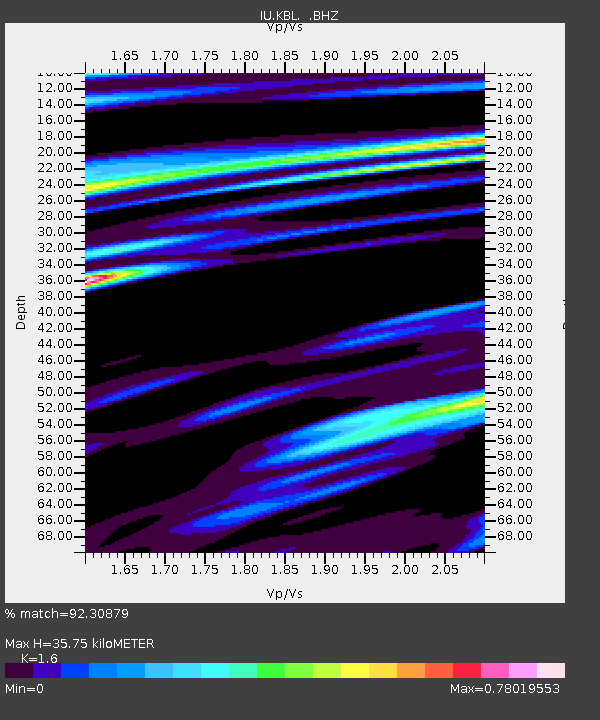
KBL Kabul, Afghanistan - Earthquake Result Viewer
| ||||||||||||||||||
| ||||||||||||||||||
| ||||||||||||||||||
|
Signal To Noise
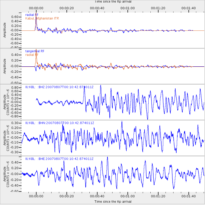
| Channel | StoN | STA | LTA |
| IU:KBL: :BHN:20070807T00:10:42.874011Z | 1.0895476 | 4.8221676E-8 | 4.4258435E-8 |
| IU:KBL: :BHE:20070807T00:10:42.874011Z | 5.115959 | 1.5115253E-7 | 2.9545298E-8 |
| IU:KBL: :BHZ:20070807T00:10:42.874011Z | 4.3311353 | 3.188899E-7 | 7.362733E-8 |
| Arrivals | |
| Ps | 3.5 SECOND |
| PpPs | 13 SECOND |
| PsPs/PpSs | 17 SECOND |

