
KBL Kabul, Afghanistan - Earthquake Result Viewer
| ||||||||||||||||||
| ||||||||||||||||||
| ||||||||||||||||||
|
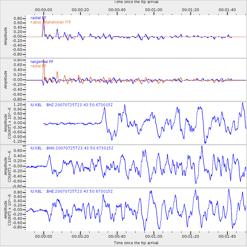
Signal To Noise
| Channel | StoN | STA | LTA |
| IU:KBL: :BHN:20070725T23:43:50.673015Z | 8.5333395 | 1.8467908E-7 | 2.1642064E-8 |
| IU:KBL: :BHE:20070725T23:43:50.673015Z | 7.3822656 | 2.0261469E-7 | 2.744614E-8 |
| IU:KBL: :BHZ:20070725T23:43:50.673015Z | 13.882209 | 4.4675835E-7 | 3.218208E-8 |
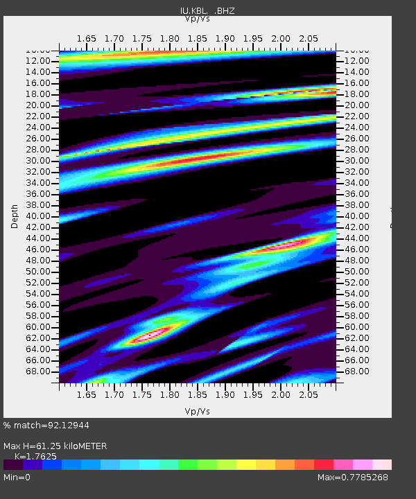
| Arrivals | |
| Ps | 7.6 SECOND |
| PpPs | 23 SECOND |
| PsPs/PpSs | 31 SECOND |

