You are here: Home > Network List > IU - Global Seismograph Network (GSN - IRIS/USGS) Stations List
> Station KBL Kabul, Afghanistan > Earthquake Result Viewer
KBL Kabul, Afghanistan - Earthquake Result Viewer
| Earthquake location: |
Lake Tanganyika Region |
| Earthquake latitude/longitude: |
-6.3/29.7 |
| Earthquake time(UTC): |
2007/03/28 (087) 21:17:10 GMT |
| Earthquake Depth: |
8.0 km |
| Earthquake Magnitude: |
5.8 MB, 5.8 MS, 5.8 MW, 5.7 MW |
| Earthquake Catalog/Contributor: |
WHDF/NEIC |
|
| Network: |
IU Global Seismograph Network (GSN - IRIS/USGS) |
| Station: |
KBL Kabul, Afghanistan |
| Lat/Lon: |
34.54 N/69.04 E |
| Elevation: |
1920 m |
|
| Distance: |
55.0 deg |
| Az: |
39.719 deg |
| Baz: |
230.313 deg |
| Ray Param: |
0.065070525 |
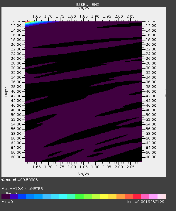
| Estimated Moho Depth: |
10.0 km |
| Estimated Crust Vp/Vs: |
1.60 |
| Assumed Crust Vp: |
6.641 km/s |
| Estimated Crust Vs: |
4.15 km/s |
| Estimated Crust Poisson's Ratio: |
0.18 |
|
| Radial Match: |
99.53885 % |
| Radial Bump: |
27 |
| Transverse Match: |
98.38473 % |
| Transverse Bump: |
38 |
| SOD ConfigId: |
2564 |
| Insert Time: |
2010-03-03 16:32:05.575 +0000 |
| GWidth: |
2.5 |
| Max Bumps: |
400 |
| Tol: |
0.001 |
|
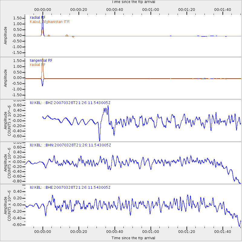
Signal To Noise
| Channel | StoN | STA | LTA |
| IU:KBL: :BHN:20070328T21:26:11.543005Z | 1.5881886 | 1.2524129E-7 | 7.8857944E-8 |
| IU:KBL: :BHE:20070328T21:26:11.543005Z | 2.3397574 | 1.2584226E-7 | 5.378432E-8 |
| IU:KBL: :BHZ:20070328T21:26:11.543005Z | 3.5362492 | 3.3100048E-7 | 9.360214E-8 |
| Arrivals |
| Ps | 1.0 SECOND |
| PpPs | 3.7 SECOND |
| PsPs/PpSs | 4.6 SECOND |


