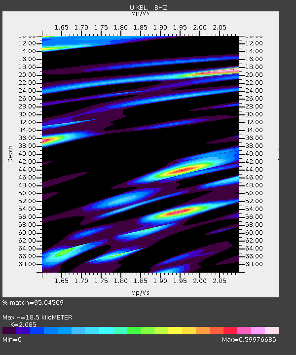
KBL Kabul, Afghanistan - Earthquake Result Viewer
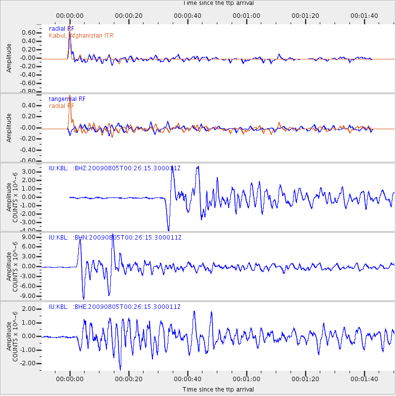
Earthquake location: Southwestern Ryukyu Isl., Japan
Earthquake latitude/longitude: 24.2/125.1
Earthquake time(UTC): 2009/08/05 (217) 00:17:58 GMT
Earthquake Depth: 25 km
Earthquake Magnitude: 5.9 MB, 5.9 MS, 6.2 MW, 6.1 MW
Earthquake Catalog/Contributor: WHDF/NEIC
Network: IU Global Seismograph Network (GSN - IRIS/USGS)
Station: KBL Kabul, Afghanistan
Lat/Lon: 34.54 N/69.04 E
Elevation: 1920 m
Distance: 49.4 deg
Az: 295.532 deg
Baz: 86.283 deg
Ray Param: 0.06870627
Estimated Moho Depth: 18.5 km
Estimated Crust Vp/Vs: 2.09
Assumed Crust Vp: 6.641 km/s
Estimated Crust Vs: 3.185 km/s
Estimated Crust Poisson's Ratio: 0.35
Radial Match: 95.04509 %
Radial Bump: 400
Transverse Match: 94.17331 %
Transverse Bump: 400
SOD ConfigId: 2622
Insert Time: 2010-03-03 16:32:20.123 +0000
GWidth: 2.5
Max Bumps: 400
Tol: 0.001

Signal To Noise

ChannelStoNSTALTA
IU:KBL: :BHN:20090805T00:26:15.300011Z70.7055744.250378E-66.011376E-8
IU:KBL: :BHE:20090805T00:26:15.300011Z17.5465434.4186513E-72.518246E-8
IU:KBL: :BHZ:20090805T00:26:15.300011Z42.5416871.7040161E-64.005521E-8
Arrivals
Ps3.2 SECOND
PpPs8.1 SECOND
PsPs/PpSs11 SECOND