
KBL Kabul, Afghanistan - Earthquake Result Viewer
| ||||||||||||||||||
| ||||||||||||||||||
| ||||||||||||||||||
|
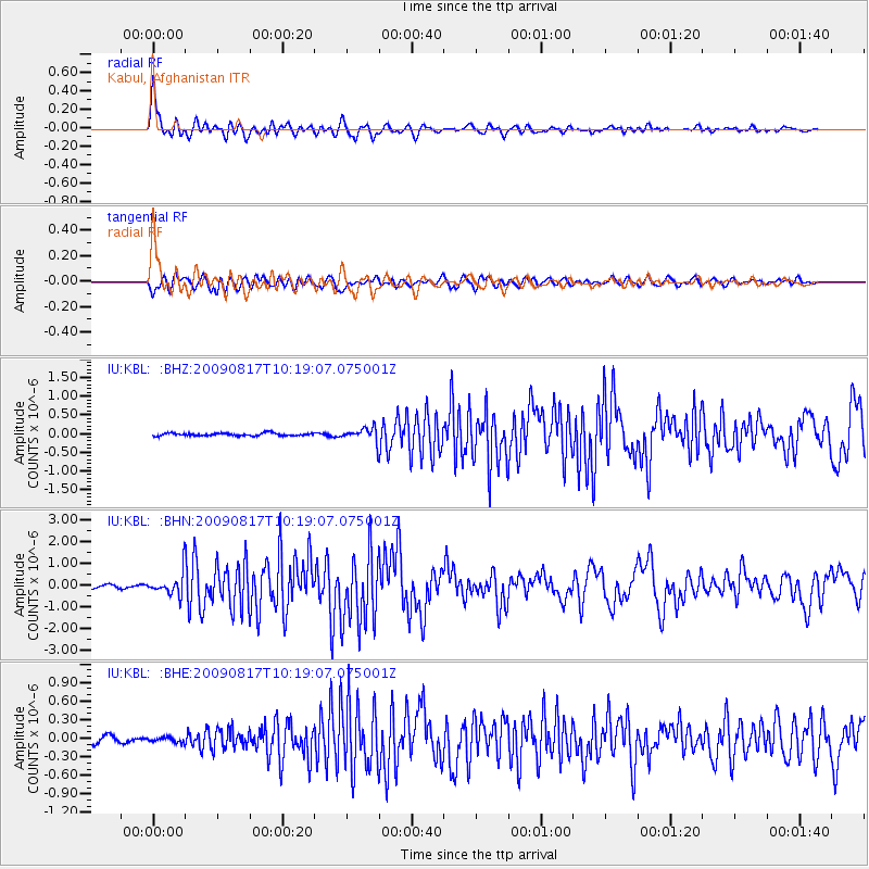
Signal To Noise
| Channel | StoN | STA | LTA |
| IU:KBL: :BHN:20090817T10:19:07.075001Z | 9.218917 | 4.981702E-7 | 5.4037823E-8 |
| IU:KBL: :BHE:20090817T10:19:07.075001Z | 0.784281 | 4.100221E-8 | 5.2279997E-8 |
| IU:KBL: :BHZ:20090817T10:19:07.075001Z | 5.0979443 | 1.890689E-7 | 3.708728E-8 |
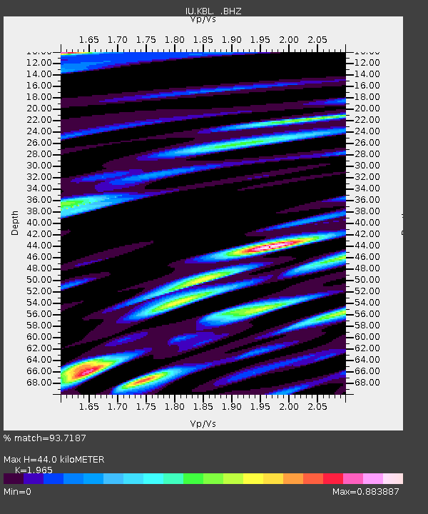
| Arrivals | |
| Ps | 6.8 SECOND |
| PpPs | 19 SECOND |
| PsPs/PpSs | 25 SECOND |

