You are here: Home > Network List > IU - Global Seismograph Network (GSN - IRIS/USGS) Stations List
> Station KBL Kabul, Afghanistan > Earthquake Result Viewer
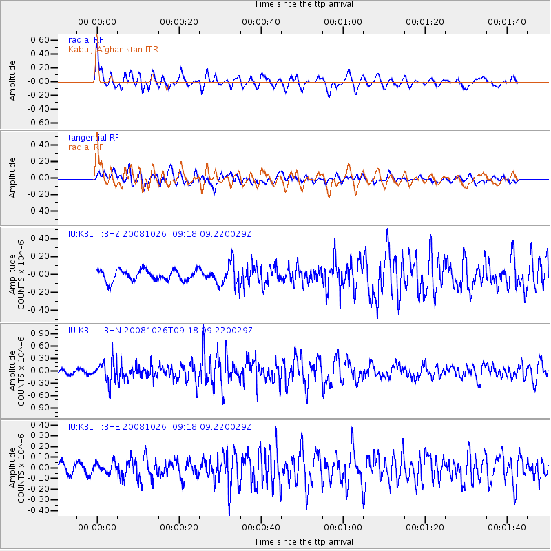
KBL Kabul, Afghanistan - Earthquake Result Viewer
*The percent match for this event was below the threshold and hence no stack was calculated.
| Earthquake location: |
Minahassa Peninsula, Sulawesi |
| Earthquake latitude/longitude: |
-0.1/123.0 |
| Earthquake time(UTC): |
2008/10/26 (300) 09:08:34 GMT |
| Earthquake Depth: |
81 km |
| Earthquake Magnitude: |
5.5 MB, 5.6 MW, 5.6 MW |
| Earthquake Catalog/Contributor: |
WHDF/NEIC |
|
| Network: |
IU Global Seismograph Network (GSN - IRIS/USGS) |
| Station: |
KBL Kabul, Afghanistan |
| Lat/Lon: |
34.54 N/69.04 E |
| Elevation: |
1920 m |
|
| Distance: |
61.0 deg |
| Az: |
310.271 deg |
| Baz: |
112.44 deg |
| Ray Param: |
$rayparam |
*The percent match for this event was below the threshold and hence was not used in the summary stack. |
|
| Radial Match: |
78.18848 % |
| Radial Bump: |
400 |
| Transverse Match: |
69.329735 % |
| Transverse Bump: |
400 |
| SOD ConfigId: |
2560 |
| Insert Time: |
2010-03-03 16:34:47.083 +0000 |
| GWidth: |
2.5 |
| Max Bumps: |
400 |
| Tol: |
0.001 |
|
Signal To Noise
| Channel | StoN | STA | LTA |
| IU:KBL: :BHN:20081026T09:18:09.220029Z | 3.434142 | 2.7502423E-7 | 8.0085286E-8 |
| IU:KBL: :BHE:20081026T09:18:09.220029Z | 1.1306918 | 5.0022898E-8 | 4.424097E-8 |
| IU:KBL: :BHZ:20081026T09:18:09.220029Z | 2.2446177 | 1.3600642E-7 | 6.059224E-8 |
| Arrivals |
| Ps | |
| PpPs | |
| PsPs/PpSs | |


