You are here: Home > Network List > US - United States National Seismic Network Stations List
> Station BRAL Brewton, Alabama, USA > Earthquake Result Viewer
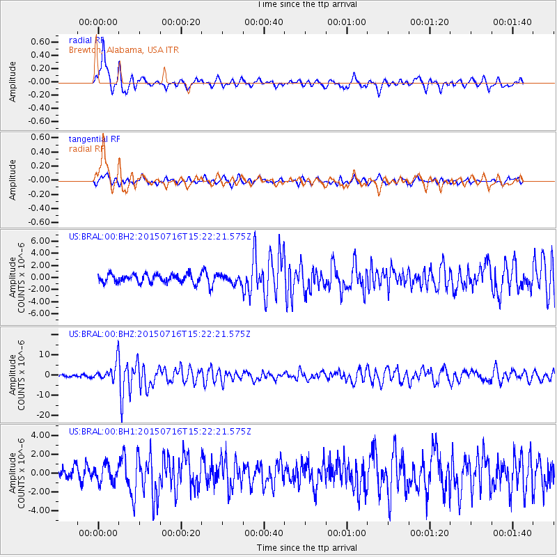
BRAL Brewton, Alabama, USA - Earthquake Result Viewer
*The percent match for this event was below the threshold and hence no stack was calculated.
| Earthquake location: |
North Atlantic Ocean |
| Earthquake latitude/longitude: |
13.9/-58.5 |
| Earthquake time(UTC): |
2015/07/16 (197) 15:16:32 GMT |
| Earthquake Depth: |
10 km |
| Earthquake Magnitude: |
6.5 MWW, 6.5 MWC, 6.5 MWB, 6.5 MI |
| Earthquake Catalog/Contributor: |
NEIC PDE/NEIC COMCAT |
|
| Network: |
US United States National Seismic Network |
| Station: |
BRAL Brewton, Alabama, USA |
| Lat/Lon: |
31.17 N/87.05 W |
| Elevation: |
61 m |
|
| Distance: |
31.3 deg |
| Az: |
308.122 deg |
| Baz: |
116.949 deg |
| Ray Param: |
$rayparam |
*The percent match for this event was below the threshold and hence was not used in the summary stack. |
|
| Radial Match: |
78.269684 % |
| Radial Bump: |
400 |
| Transverse Match: |
67.54481 % |
| Transverse Bump: |
400 |
| SOD ConfigId: |
7422571 |
| Insert Time: |
2019-04-19 20:20:24.186 +0000 |
| GWidth: |
2.5 |
| Max Bumps: |
400 |
| Tol: |
0.001 |
|
Signal To Noise
| Channel | StoN | STA | LTA |
| US:BRAL:00:BHZ:20150716T15:22:21.575Z | 9.879506 | 4.49085E-6 | 4.5456218E-7 |
| US:BRAL:00:BH1:20150716T15:22:21.575Z | 1.5249133 | 9.147162E-7 | 5.99848E-7 |
| US:BRAL:00:BH2:20150716T15:22:21.575Z | 1.3900883 | 9.644305E-7 | 6.9379075E-7 |
| Arrivals |
| Ps | |
| PpPs | |
| PsPs/PpSs | |


