You are here: Home > Network List > CI - Caltech Regional Seismic Network Stations List
> Station MPP McPhearson Peak > Earthquake Result Viewer
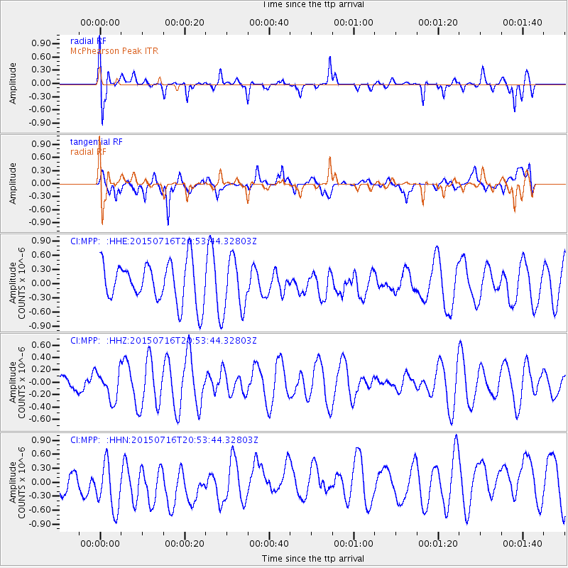
MPP McPhearson Peak - Earthquake Result Viewer
*The percent match for this event was below the threshold and hence no stack was calculated.
| Earthquake location: |
South Of Kermadec Islands |
| Earthquake latitude/longitude: |
-32.3/-177.8 |
| Earthquake time(UTC): |
2015/07/16 (197) 20:41:36 GMT |
| Earthquake Depth: |
20 km |
| Earthquake Magnitude: |
5.0 MW |
| Earthquake Catalog/Contributor: |
ISC/ISC |
|
| Network: |
CI Caltech Regional Seismic Network |
| Station: |
MPP McPhearson Peak |
| Lat/Lon: |
34.89 N/119.81 W |
| Elevation: |
1739 m |
|
| Distance: |
86.2 deg |
| Az: |
44.302 deg |
| Baz: |
226.047 deg |
| Ray Param: |
$rayparam |
*The percent match for this event was below the threshold and hence was not used in the summary stack. |
|
| Radial Match: |
55.233707 % |
| Radial Bump: |
400 |
| Transverse Match: |
55.698635 % |
| Transverse Bump: |
400 |
| SOD ConfigId: |
7422571 |
| Insert Time: |
2019-04-19 20:24:54.933 +0000 |
| GWidth: |
2.5 |
| Max Bumps: |
400 |
| Tol: |
0.001 |
|
Signal To Noise
| Channel | StoN | STA | LTA |
| CI:MPP: :HHZ:20150716T20:53:44.32803Z | 1.3871379 | 2.3232748E-7 | 1.6748695E-7 |
| CI:MPP: :HHN:20150716T20:53:44.32803Z | 1.3499486 | 6.606921E-7 | 4.894202E-7 |
| CI:MPP: :HHE:20150716T20:53:44.32803Z | 1.2737364 | 5.454001E-7 | 4.2818917E-7 |
| Arrivals |
| Ps | |
| PpPs | |
| PsPs/PpSs | |


