You are here: Home > Network List > TA - USArray Transportable Network (new EarthScope stations) Stations List
> Station 833A Chaparral WMA, Artesia Wells, TX, USA > Earthquake Result Viewer
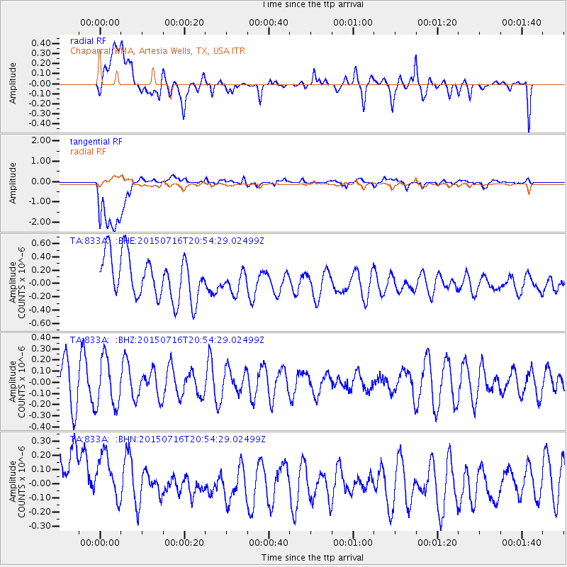
833A Chaparral WMA, Artesia Wells, TX, USA - Earthquake Result Viewer
*The percent match for this event was below the threshold and hence no stack was calculated.
| Earthquake location: |
South Of Kermadec Islands |
| Earthquake latitude/longitude: |
-32.3/-177.8 |
| Earthquake time(UTC): |
2015/07/16 (197) 20:41:36 GMT |
| Earthquake Depth: |
20 km |
| Earthquake Magnitude: |
5.0 MW |
| Earthquake Catalog/Contributor: |
ISC/ISC |
|
| Network: |
TA USArray Transportable Network (new EarthScope stations) |
| Station: |
833A Chaparral WMA, Artesia Wells, TX, USA |
| Lat/Lon: |
28.32 N/99.39 W |
| Elevation: |
171 m |
|
| Distance: |
95.8 deg |
| Az: |
60.217 deg |
| Baz: |
236.529 deg |
| Ray Param: |
$rayparam |
*The percent match for this event was below the threshold and hence was not used in the summary stack. |
|
| Radial Match: |
39.377235 % |
| Radial Bump: |
400 |
| Transverse Match: |
80.6623 % |
| Transverse Bump: |
400 |
| SOD ConfigId: |
7422571 |
| Insert Time: |
2019-04-19 20:26:33.722 +0000 |
| GWidth: |
2.5 |
| Max Bumps: |
400 |
| Tol: |
0.001 |
|
Signal To Noise
| Channel | StoN | STA | LTA |
| TA:833A: :BHZ:20150716T20:54:29.02499Z | 1.1747711 | 2.141729E-7 | 1.8231033E-7 |
| TA:833A: :BHN:20150716T20:54:29.02499Z | 0.7301869 | 3.1808003E-7 | 4.3561457E-7 |
| TA:833A: :BHE:20150716T20:54:29.02499Z | 0.5137597 | 1.6751707E-7 | 3.2606118E-7 |
| Arrivals |
| Ps | |
| PpPs | |
| PsPs/PpSs | |


