You are here: Home > Network List > G - GEOSCOPE Stations List
> Station PPTF Pamatai - Papeete - Tahiti island - French Polynesia, France > Earthquake Result Viewer
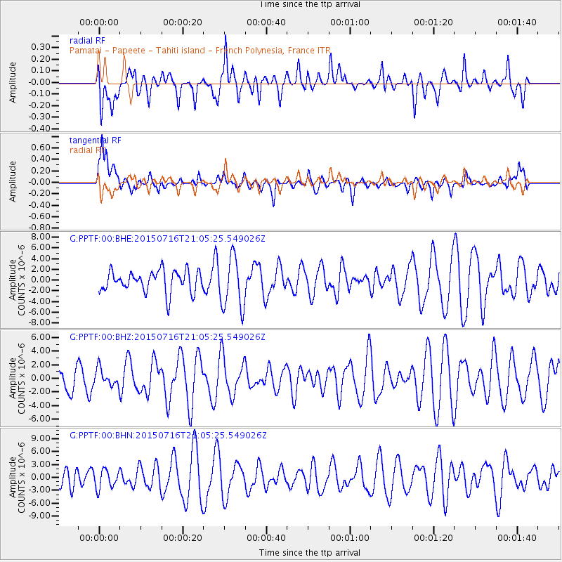
PPTF Pamatai - Papeete - Tahiti island - French Polynesia, France - Earthquake Result Viewer
*The percent match for this event was below the threshold and hence no stack was calculated.
| Earthquake location: |
Mindanao, Philippines |
| Earthquake latitude/longitude: |
9.1/126.9 |
| Earthquake time(UTC): |
2015/07/16 (197) 20:53:15 GMT |
| Earthquake Depth: |
26 km |
| Earthquake Magnitude: |
5.3 MW |
| Earthquake Catalog/Contributor: |
ISC/ISC |
|
| Network: |
G GEOSCOPE |
| Station: |
PPTF Pamatai - Papeete - Tahiti island - French Polynesia, France |
| Lat/Lon: |
17.59 S/149.57 W |
| Elevation: |
705 m |
|
| Distance: |
86.7 deg |
| Az: |
108.298 deg |
| Baz: |
280.611 deg |
| Ray Param: |
$rayparam |
*The percent match for this event was below the threshold and hence was not used in the summary stack. |
|
| Radial Match: |
47.912453 % |
| Radial Bump: |
400 |
| Transverse Match: |
53.649433 % |
| Transverse Bump: |
400 |
| SOD ConfigId: |
7422571 |
| Insert Time: |
2019-04-19 20:29:48.495 +0000 |
| GWidth: |
2.5 |
| Max Bumps: |
400 |
| Tol: |
0.001 |
|
Signal To Noise
| Channel | StoN | STA | LTA |
| G:PPTF:00:BHZ:20150716T21:05:25.549026Z | 0.708395 | 1.3397183E-6 | 1.8912023E-6 |
| G:PPTF:00:BHN:20150716T21:05:25.549026Z | 1.021329 | 2.2279198E-6 | 2.1813926E-6 |
| G:PPTF:00:BHE:20150716T21:05:25.549026Z | 2.4938169 | 4.9228693E-6 | 1.97403E-6 |
| Arrivals |
| Ps | |
| PpPs | |
| PsPs/PpSs | |


