KIP Kipapa, Hawaii, USA - Earthquake Result Viewer
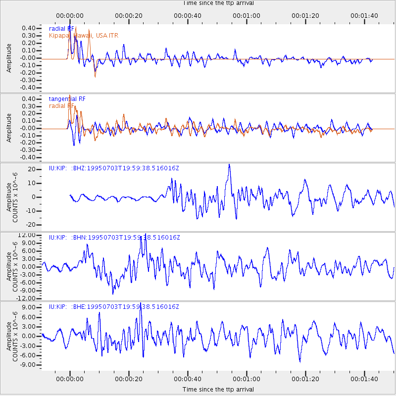
Earthquake location: Kermadec Islands, New Zealand
Earthquake latitude/longitude: -29.2/-177.6
Earthquake time(UTC): 1995/07/03 (184) 19:50:50 GMT
Earthquake Depth: 33 km
Earthquake Magnitude: 6.5 MB, 7.2 MS, 7.2 UNKNOWN, 7.2 MW
Earthquake Catalog/Contributor: WHDF/NEIC
Network: IU Global Seismograph Network (GSN - IRIS/USGS)
Station: KIP Kipapa, Hawaii, USA
Lat/Lon: 21.42 N/158.01 W
Elevation: 70 m
Distance: 53.8 deg
Az: 22.798 deg
Baz: 201.322 deg
Ray Param: 0.065823786
Estimated Moho Depth: 12.5 km
Estimated Crust Vp/Vs: 1.63
Assumed Crust Vp: 4.24 km/s
Estimated Crust Vs: 2.605 km/s
Estimated Crust Poisson's Ratio: 0.20
Radial Match: 89.74554 %
Radial Bump: 400
Transverse Match: 68.45293 %
Transverse Bump: 400
SOD ConfigId: 6273
Insert Time: 2010-03-03 16:36:56.888 +0000
GWidth: 2.5
Max Bumps: 400
Tol: 0.001

Signal To Noise

ChannelStoNSTALTA
IU:KIP: :BHN:19950703T19:59:38.516016Z2.0436671.9981564E-69.777309E-7
IU:KIP: :BHE:19950703T19:59:38.516016Z1.43035551.6511948E-61.1543947E-6
IU:KIP: :BHZ:19950703T19:59:38.516016Z4.02222635.406711E-61.3442086E-6
Arrivals
Ps1.9 SECOND
PpPs7.6 SECOND
PsPs/PpSs9.5 SECOND