KIP Kipapa, Hawaii, USA - Earthquake Result Viewer
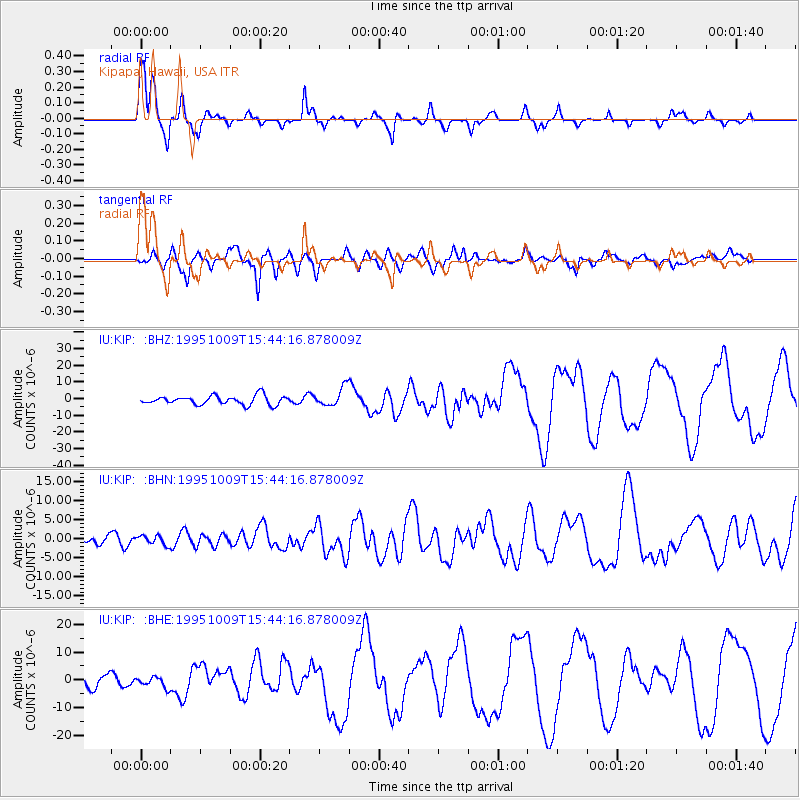
Earthquake location: Near Coast Of Jalisco, Mexico
Earthquake latitude/longitude: 19.1/-104.2
Earthquake time(UTC): 1995/10/09 (282) 15:35:55 GMT
Earthquake Depth: 49 km
Earthquake Magnitude: 6.5 MB, 7.3 MS, 7.3 UNKNOWN, 7.9 MW
Earthquake Catalog/Contributor: WHDF/NEIC
Network: IU Global Seismograph Network (GSN - IRIS/USGS)
Station: KIP Kipapa, Hawaii, USA
Lat/Lon: 21.42 N/158.01 W
Elevation: 70 m
Distance: 50.3 deg
Az: 282.295 deg
Baz: 82.458 deg
Ray Param: 0.06801829
Estimated Moho Depth: 10.75 km
Estimated Crust Vp/Vs: 1.81
Assumed Crust Vp: 4.24 km/s
Estimated Crust Vs: 2.346 km/s
Estimated Crust Poisson's Ratio: 0.28
Radial Match: 95.3282 %
Radial Bump: 325
Transverse Match: 79.73203 %
Transverse Bump: 400
SOD ConfigId: 6273
Insert Time: 2010-03-03 16:37:01.880 +0000
GWidth: 2.5
Max Bumps: 400
Tol: 0.001

Signal To Noise

ChannelStoNSTALTA
IU:KIP: :BHN:19951009T15:44:16.878009Z1.26185391.1984484E-69.497522E-7
IU:KIP: :BHE:19951009T15:44:16.878009Z1.20646021.9527333E-61.6185643E-6
IU:KIP: :BHZ:19951009T15:44:16.878009Z2.0737545.553425E-62.6779571E-6
Arrivals
Ps2.1 SECOND
PpPs7.0 SECOND
PsPs/PpSs9.0 SECOND