You are here: Home > Network List > TA - USArray Transportable Network (new EarthScope stations) Stations List
> Station MSTX Muleshoe, TX, USA > Earthquake Result Viewer
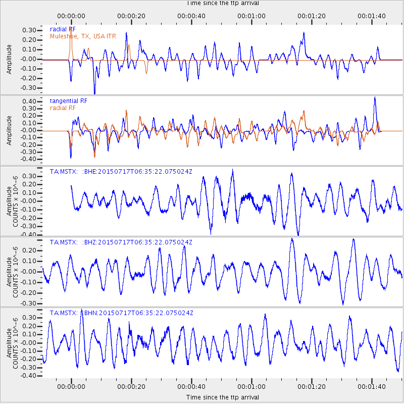
MSTX Muleshoe, TX, USA - Earthquake Result Viewer
*The percent match for this event was below the threshold and hence no stack was calculated.
| Earthquake location: |
South Of Kermadec Islands |
| Earthquake latitude/longitude: |
-32.3/-177.8 |
| Earthquake time(UTC): |
2015/07/17 (198) 06:22:24 GMT |
| Earthquake Depth: |
10 km |
| Earthquake Magnitude: |
4.9 MW |
| Earthquake Catalog/Contributor: |
ISC/ISC |
|
| Network: |
TA USArray Transportable Network (new EarthScope stations) |
| Station: |
MSTX Muleshoe, TX, USA |
| Lat/Lon: |
33.97 N/102.77 W |
| Elevation: |
1167 m |
|
| Distance: |
96.6 deg |
| Az: |
53.913 deg |
| Baz: |
235.408 deg |
| Ray Param: |
$rayparam |
*The percent match for this event was below the threshold and hence was not used in the summary stack. |
|
| Radial Match: |
44.77976 % |
| Radial Bump: |
400 |
| Transverse Match: |
43.754585 % |
| Transverse Bump: |
400 |
| SOD ConfigId: |
7422571 |
| Insert Time: |
2019-04-19 20:36:55.756 +0000 |
| GWidth: |
2.5 |
| Max Bumps: |
400 |
| Tol: |
0.001 |
|
Signal To Noise
| Channel | StoN | STA | LTA |
| TA:MSTX: :BHZ:20150717T06:35:22.075024Z | 0.7568531 | 7.537506E-8 | 9.959008E-8 |
| TA:MSTX: :BHN:20150717T06:35:22.075024Z | 1.6469113 | 1.9569896E-7 | 1.1882788E-7 |
| TA:MSTX: :BHE:20150717T06:35:22.075024Z | 1.1462708 | 8.069117E-8 | 7.039451E-8 |
| Arrivals |
| Ps | |
| PpPs | |
| PsPs/PpSs | |


