
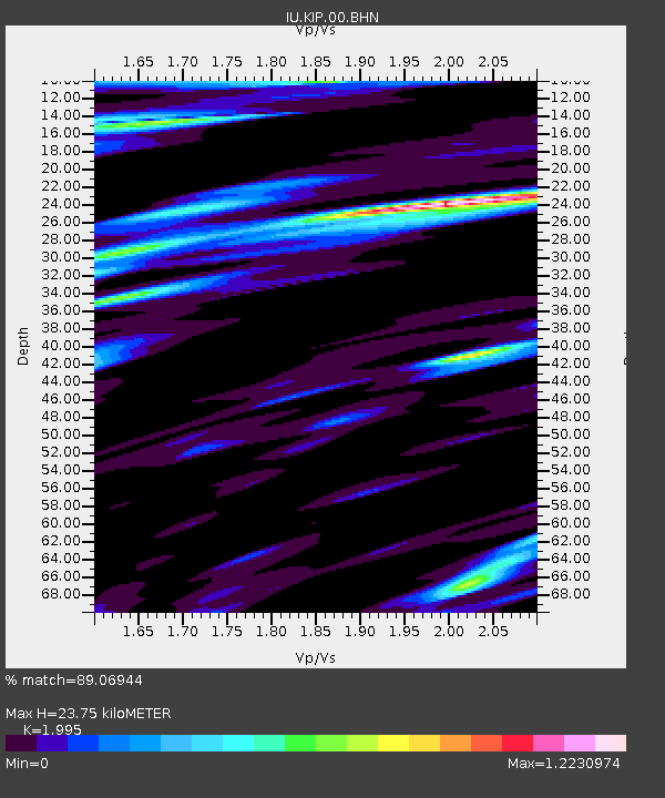
KIP Kipapa, Hawaii, USA - Earthquake Result Viewer
| ||||||||||||||||||
| ||||||||||||||||||
| ||||||||||||||||||
|
Signal To Noise
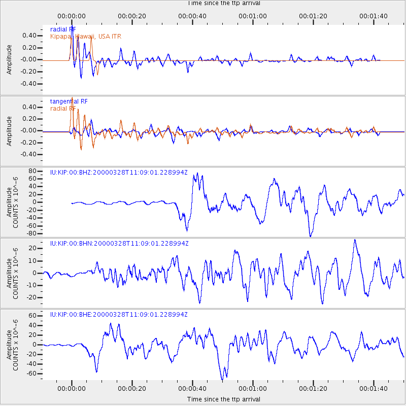
| Channel | StoN | STA | LTA |
| IU:KIP:00:BHN:20000328T11:09:01.228994Z | 1.0481116 | 1.2009199E-6 | 1.145794E-6 |
| IU:KIP:00:BHE:20000328T11:09:01.228994Z | 2.1090517 | 2.6431046E-6 | 1.2532195E-6 |
| IU:KIP:00:BHZ:20000328T11:09:01.228994Z | 1.1793468 | 3.0218644E-6 | 2.5623203E-6 |
| Arrivals | |
| Ps | 5.7 SECOND |
| PpPs | 16 SECOND |
| PsPs/PpSs | 22 SECOND |

