KIP Kipapa, Hawaii, USA - Earthquake Result Viewer
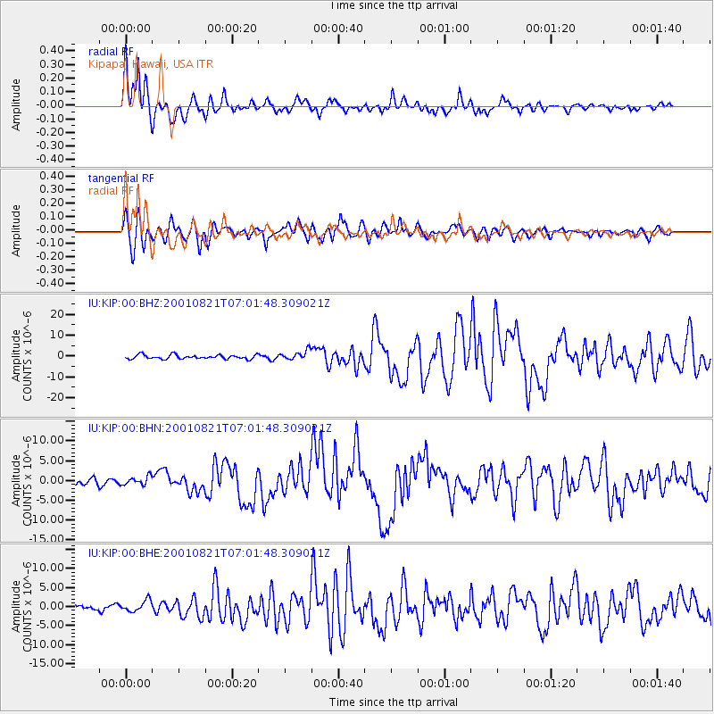
Earthquake location: East Of North Island, N.Z.
Earthquake latitude/longitude: -36.8/-179.6
Earthquake time(UTC): 2001/08/21 (233) 06:52:06 GMT
Earthquake Depth: 33 km
Earthquake Magnitude: 6.4 MB, 7.1 MS, 7.2 ME, 7.0 ML
Earthquake Catalog/Contributor: WHDF/NEIC
Network: IU Global Seismograph Network (GSN - IRIS/USGS)
Station: KIP Kipapa, Hawaii, USA
Lat/Lon: 21.42 N/158.01 W
Elevation: 70 m
Distance: 61.4 deg
Az: 22.954 deg
Baz: 199.628 deg
Ray Param: 0.06084647
Estimated Moho Depth: 11.25 km
Estimated Crust Vp/Vs: 1.90
Assumed Crust Vp: 4.24 km/s
Estimated Crust Vs: 2.234 km/s
Estimated Crust Poisson's Ratio: 0.31
Radial Match: 91.878685 %
Radial Bump: 400
Transverse Match: 82.60354 %
Transverse Bump: 400
SOD ConfigId: 20082
Insert Time: 2010-03-03 16:37:36.931 +0000
GWidth: 2.5
Max Bumps: 400
Tol: 0.001

Signal To Noise

ChannelStoNSTALTA
IU:KIP:00:BHN:20010821T07:01:48.309021Z1.28715361.0672378E-68.291456E-7
IU:KIP:00:BHE:20010821T07:01:48.309021Z2.05635641.4885484E-67.238766E-7
IU:KIP:00:BHZ:20010821T07:01:48.309021Z2.3306152.2859645E-69.808417E-7
Arrivals
Ps2.4 SECOND
PpPs7.6 SECOND
PsPs/PpSs10.0 SECOND