You are here: Home > Network List > IU - Global Seismograph Network (GSN - IRIS/USGS) Stations List
> Station KIP Kipapa, Hawaii, USA > Earthquake Result Viewer
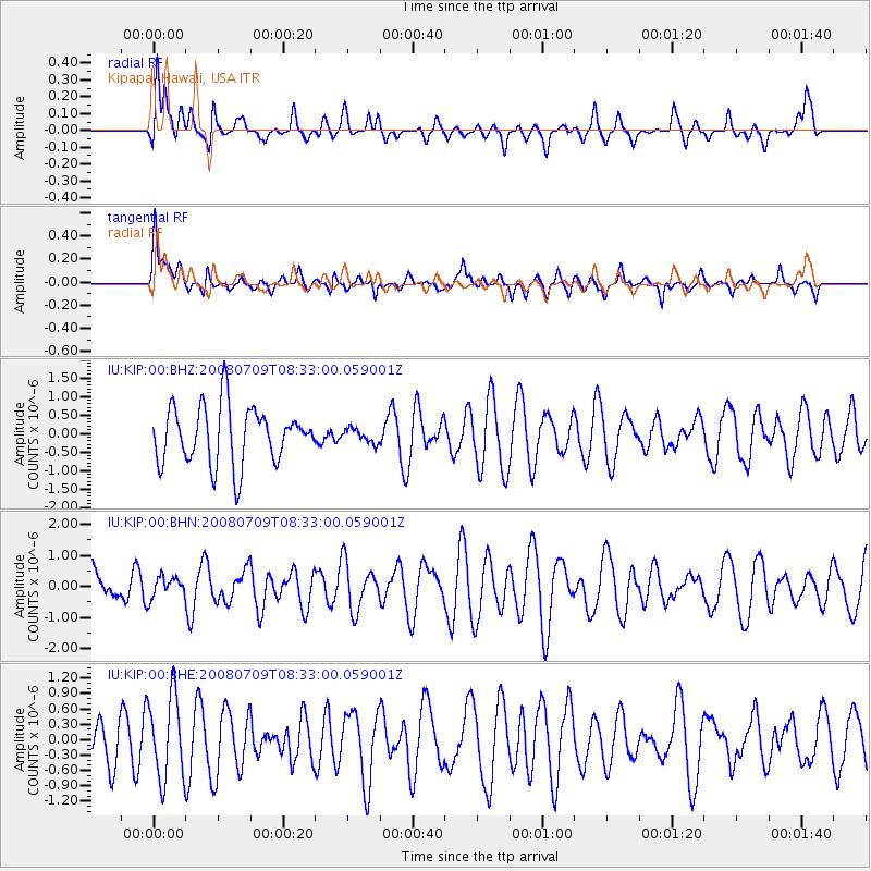
KIP Kipapa, Hawaii, USA - Earthquake Result Viewer
*The percent match for this event was below the threshold and hence no stack was calculated.
| Earthquake location: |
Loyalty Islands |
| Earthquake latitude/longitude: |
-20.9/168.8 |
| Earthquake time(UTC): |
2008/07/09 (191) 08:24:16 GMT |
| Earthquake Depth: |
39 km |
| Earthquake Magnitude: |
5.6 MB, 4.9 MS, 5.4 MW |
| Earthquake Catalog/Contributor: |
WHDF/NEIC |
|
| Network: |
IU Global Seismograph Network (GSN - IRIS/USGS) |
| Station: |
KIP Kipapa, Hawaii, USA |
| Lat/Lon: |
21.42 N/158.01 W |
| Elevation: |
70 m |
|
| Distance: |
53.1 deg |
| Az: |
39.636 deg |
| Baz: |
219.797 deg |
| Ray Param: |
$rayparam |
*The percent match for this event was below the threshold and hence was not used in the summary stack. |
|
| Radial Match: |
41.49823 % |
| Radial Bump: |
400 |
| Transverse Match: |
60.327366 % |
| Transverse Bump: |
400 |
| SOD ConfigId: |
2504 |
| Insert Time: |
2010-03-03 16:37:44.369 +0000 |
| GWidth: |
2.5 |
| Max Bumps: |
400 |
| Tol: |
0.001 |
|
Signal To Noise
| Channel | StoN | STA | LTA |
| IU:KIP:00:BHN:20080709T08:33:00.059001Z | 0.45875934 | 3.3899292E-7 | 7.389341E-7 |
| IU:KIP:00:BHE:20080709T08:33:00.059001Z | 1.9180541 | 8.053976E-7 | 4.1990347E-7 |
| IU:KIP:00:BHZ:20080709T08:33:00.059001Z | 0.24672283 | 1.9008672E-7 | 7.704464E-7 |
| Arrivals |
| Ps | |
| PpPs | |
| PsPs/PpSs | |


