You are here: Home > Network List > IU - Global Seismograph Network (GSN - IRIS/USGS) Stations List
> Station KIP Kipapa, Hawaii, USA > Earthquake Result Viewer
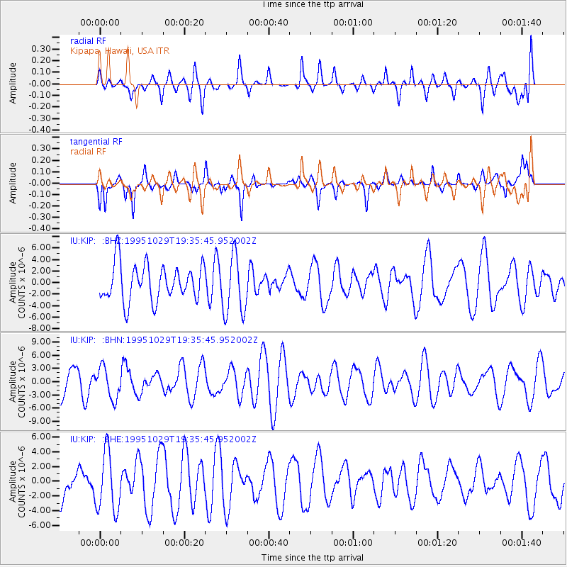
KIP Kipapa, Hawaii, USA - Earthquake Result Viewer
*The percent match for this event was below the threshold and hence no stack was calculated.
| Earthquake location: |
Northern Molucca Sea |
| Earthquake latitude/longitude: |
0.8/126.0 |
| Earthquake time(UTC): |
1995/10/29 (302) 19:24:29 GMT |
| Earthquake Depth: |
33 km |
| Earthquake Magnitude: |
6.1 MB, 5.4 MS |
| Earthquake Catalog/Contributor: |
WHDF/NEIC |
|
| Network: |
IU Global Seismograph Network (GSN - IRIS/USGS) |
| Station: |
KIP Kipapa, Hawaii, USA |
| Lat/Lon: |
21.42 N/158.01 W |
| Elevation: |
70 m |
|
| Distance: |
76.7 deg |
| Az: |
68.3 deg |
| Baz: |
265.633 deg |
| Ray Param: |
$rayparam |
*The percent match for this event was below the threshold and hence was not used in the summary stack. |
|
| Radial Match: |
46.824352 % |
| Radial Bump: |
400 |
| Transverse Match: |
63.690376 % |
| Transverse Bump: |
359 |
| SOD ConfigId: |
4480 |
| Insert Time: |
2010-03-03 16:37:57.731 +0000 |
| GWidth: |
2.5 |
| Max Bumps: |
400 |
| Tol: |
0.001 |
|
Signal To Noise
| Channel | StoN | STA | LTA |
| IU:KIP: :BHN:19951029T19:35:45.952002Z | 1.1624012 | 3.6029032E-6 | 3.099535E-6 |
| IU:KIP: :BHE:19951029T19:35:45.952002Z | 1.2202812 | 4.1042763E-6 | 3.3633853E-6 |
| IU:KIP: :BHZ:19951029T19:35:45.952002Z | 1.6469821 | 5.1750376E-6 | 3.1421332E-6 |
| Arrivals |
| Ps | |
| PpPs | |
| PsPs/PpSs | |


