You are here: Home > Network List > IU - Global Seismograph Network (GSN - IRIS/USGS) Stations List
> Station KIP Kipapa, Hawaii, USA > Earthquake Result Viewer
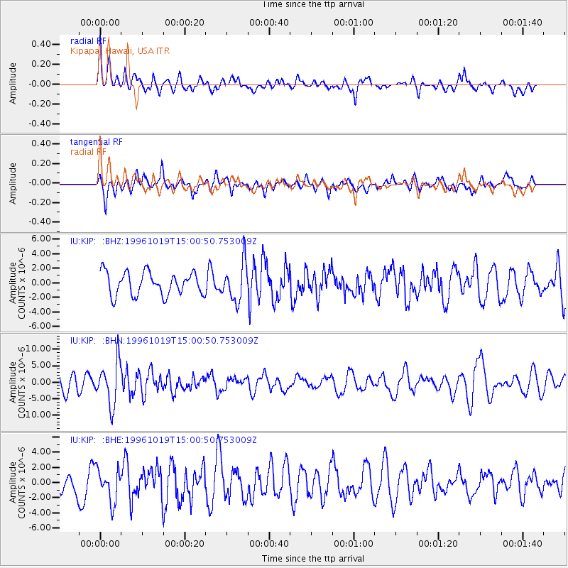
KIP Kipapa, Hawaii, USA - Earthquake Result Viewer
*The percent match for this event was below the threshold and hence no stack was calculated.
| Earthquake location: |
Fiji Islands Region |
| Earthquake latitude/longitude: |
-20.4/-178.5 |
| Earthquake time(UTC): |
1996/10/19 (293) 14:53:48 GMT |
| Earthquake Depth: |
591 km |
| Earthquake Magnitude: |
6.1 MB, 6.9 UNKNOWN, 6.8 MW |
| Earthquake Catalog/Contributor: |
WHDF/NEIC |
|
| Network: |
IU Global Seismograph Network (GSN - IRIS/USGS) |
| Station: |
KIP Kipapa, Hawaii, USA |
| Lat/Lon: |
21.42 N/158.01 W |
| Elevation: |
70 m |
|
| Distance: |
46.2 deg |
| Az: |
26.893 deg |
| Baz: |
207.088 deg |
| Ray Param: |
$rayparam |
*The percent match for this event was below the threshold and hence was not used in the summary stack. |
|
| Radial Match: |
61.720127 % |
| Radial Bump: |
400 |
| Transverse Match: |
60.743385 % |
| Transverse Bump: |
400 |
| SOD ConfigId: |
4480 |
| Insert Time: |
2010-03-03 16:39:03.238 +0000 |
| GWidth: |
2.5 |
| Max Bumps: |
400 |
| Tol: |
0.001 |
|
Signal To Noise
| Channel | StoN | STA | LTA |
| IU:KIP: :BHN:19961019T15:00:50.753009Z | 2.3519473 | 6.6504344E-6 | 2.827629E-6 |
| IU:KIP: :BHE:19961019T15:00:50.753009Z | 1.303605 | 2.1098808E-6 | 1.6184972E-6 |
| IU:KIP: :BHZ:19961019T15:00:50.753009Z | 1.7460971 | 2.7545336E-6 | 1.5775374E-6 |
| Arrivals |
| Ps | |
| PpPs | |
| PsPs/PpSs | |


