You are here: Home > Network List > IU - Global Seismograph Network (GSN - IRIS/USGS) Stations List
> Station KIP Kipapa, Hawaii, USA > Earthquake Result Viewer
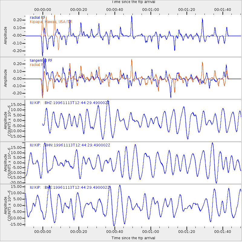
KIP Kipapa, Hawaii, USA - Earthquake Result Viewer
*The percent match for this event was below the threshold and hence no stack was calculated.
| Earthquake location: |
Near Coast Of Peru |
| Earthquake latitude/longitude: |
-15.5/-75.4 |
| Earthquake time(UTC): |
1996/11/13 (318) 12:32:09 GMT |
| Earthquake Depth: |
33 km |
| Earthquake Magnitude: |
5.8 MS, 5.4 MB, 6.1 UNKNOWN, 6.1 MW |
| Earthquake Catalog/Contributor: |
WHDF/NEIC |
|
| Network: |
IU Global Seismograph Network (GSN - IRIS/USGS) |
| Station: |
KIP Kipapa, Hawaii, USA |
| Lat/Lon: |
21.42 N/158.01 W |
| Elevation: |
70 m |
|
| Distance: |
88.9 deg |
| Az: |
292.459 deg |
| Baz: |
106.989 deg |
| Ray Param: |
$rayparam |
*The percent match for this event was below the threshold and hence was not used in the summary stack. |
|
| Radial Match: |
41.4992 % |
| Radial Bump: |
317 |
| Transverse Match: |
37.01257 % |
| Transverse Bump: |
400 |
| SOD ConfigId: |
4480 |
| Insert Time: |
2010-03-03 16:39:18.140 +0000 |
| GWidth: |
2.5 |
| Max Bumps: |
400 |
| Tol: |
0.001 |
|
Signal To Noise
| Channel | StoN | STA | LTA |
| IU:KIP: :BHN:19961113T12:44:29.490002Z | 1.2668935 | 1.1252531E-5 | 8.881987E-6 |
| IU:KIP: :BHE:19961113T12:44:29.490002Z | 1.951805 | 9.189602E-6 | 4.708258E-6 |
| IU:KIP: :BHZ:19961113T12:44:29.490002Z | 1.8060986 | 1.0513945E-5 | 5.8213573E-6 |
| Arrivals |
| Ps | |
| PpPs | |
| PsPs/PpSs | |


