You are here: Home > Network List > CI - Caltech Regional Seismic Network Stations List
> Station SWS Sam W. Stewart, Westmorland, CA, USA > Earthquake Result Viewer
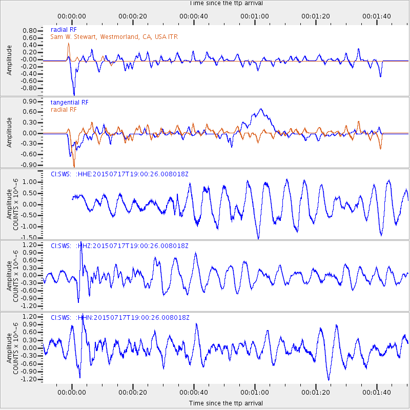
SWS Sam W. Stewart, Westmorland, CA, USA - Earthquake Result Viewer
*The percent match for this event was below the threshold and hence no stack was calculated.
| Earthquake location: |
Fiji Islands Region |
| Earthquake latitude/longitude: |
-18.1/-178.2 |
| Earthquake time(UTC): |
2015/07/17 (198) 18:49:53 GMT |
| Earthquake Depth: |
537 km |
| Earthquake Magnitude: |
5.8 MWW, 5.8 MWC, 5.9 MWB, 5.9 MWC |
| Earthquake Catalog/Contributor: |
NEIC PDE/NEIC COMCAT |
|
| Network: |
CI Caltech Regional Seismic Network |
| Station: |
SWS Sam W. Stewart, Westmorland, CA, USA |
| Lat/Lon: |
32.94 N/115.80 W |
| Elevation: |
140 m |
|
| Distance: |
78.3 deg |
| Az: |
49.562 deg |
| Baz: |
239.409 deg |
| Ray Param: |
$rayparam |
*The percent match for this event was below the threshold and hence was not used in the summary stack. |
|
| Radial Match: |
64.35752 % |
| Radial Bump: |
400 |
| Transverse Match: |
49.07918 % |
| Transverse Bump: |
400 |
| SOD ConfigId: |
7422571 |
| Insert Time: |
2019-04-19 20:56:18.593 +0000 |
| GWidth: |
2.5 |
| Max Bumps: |
400 |
| Tol: |
0.001 |
|
Signal To Noise
| Channel | StoN | STA | LTA |
| CI:SWS: :HHZ:20150717T19:00:26.008018Z | 2.186621 | 5.218445E-7 | 2.3865343E-7 |
| CI:SWS: :HHN:20150717T19:00:26.008018Z | 2.0790849 | 7.655764E-7 | 3.6822757E-7 |
| CI:SWS: :HHE:20150717T19:00:26.008018Z | 1.0552822 | 2.7561506E-7 | 2.6117664E-7 |
| Arrivals |
| Ps | |
| PpPs | |
| PsPs/PpSs | |


