You are here: Home > Network List > IU - Global Seismograph Network (GSN - IRIS/USGS) Stations List
> Station KIP Kipapa, Hawaii, USA > Earthquake Result Viewer
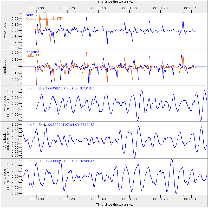
KIP Kipapa, Hawaii, USA - Earthquake Result Viewer
*The percent match for this event was below the threshold and hence no stack was calculated.
| Earthquake location: |
Minahassa Peninsula, Sulawesi |
| Earthquake latitude/longitude: |
0.3/122.5 |
| Earthquake time(UTC): |
1998/09/21 (264) 06:52:41 GMT |
| Earthquake Depth: |
147 km |
| Earthquake Magnitude: |
6.1 MB, 6.0 UNKNOWN, 5.9 MW |
| Earthquake Catalog/Contributor: |
WHDF/NEIC |
|
| Network: |
IU Global Seismograph Network (GSN - IRIS/USGS) |
| Station: |
KIP Kipapa, Hawaii, USA |
| Lat/Lon: |
21.42 N/158.01 W |
| Elevation: |
70 m |
|
| Distance: |
80.1 deg |
| Az: |
68.421 deg |
| Baz: |
266.402 deg |
| Ray Param: |
$rayparam |
*The percent match for this event was below the threshold and hence was not used in the summary stack. |
|
| Radial Match: |
39.561623 % |
| Radial Bump: |
390 |
| Transverse Match: |
48.906666 % |
| Transverse Bump: |
307 |
| SOD ConfigId: |
4480 |
| Insert Time: |
2010-03-03 16:39:23.291 +0000 |
| GWidth: |
2.5 |
| Max Bumps: |
400 |
| Tol: |
0.001 |
|
Signal To Noise
| Channel | StoN | STA | LTA |
| IU:KIP: :BHN:19980921T07:04:03.831018Z | 1.6820672 | 4.0374575E-6 | 2.4002952E-6 |
| IU:KIP: :BHE:19980921T07:04:03.829004Z | 2.6878088 | 2.9372054E-6 | 1.0927881E-6 |
| IU:KIP: :BHZ:19980921T07:04:03.831018Z | 0.66038525 | 1.2432893E-6 | 1.8826726E-6 |
| Arrivals |
| Ps | |
| PpPs | |
| PsPs/PpSs | |


