You are here: Home > Network List > IU - Global Seismograph Network (GSN - IRIS/USGS) Stations List
> Station KIP Kipapa, Hawaii, USA > Earthquake Result Viewer
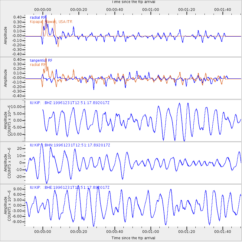
KIP Kipapa, Hawaii, USA - Earthquake Result Viewer
*The percent match for this event was below the threshold and hence no stack was calculated.
| Earthquake location: |
Mexico-Guatemala Border Region |
| Earthquake latitude/longitude: |
15.8/-93.0 |
| Earthquake time(UTC): |
1996/12/31 (366) 12:41:42 GMT |
| Earthquake Depth: |
100 km |
| Earthquake Magnitude: |
5.4 MB, 6.3 UNKNOWN, 6.3 MW |
| Earthquake Catalog/Contributor: |
WHDF/NEIC |
|
| Network: |
IU Global Seismograph Network (GSN - IRIS/USGS) |
| Station: |
KIP Kipapa, Hawaii, USA |
| Lat/Lon: |
21.42 N/158.01 W |
| Elevation: |
70 m |
|
| Distance: |
61.5 deg |
| Az: |
286.046 deg |
| Baz: |
83.132 deg |
| Ray Param: |
$rayparam |
*The percent match for this event was below the threshold and hence was not used in the summary stack. |
|
| Radial Match: |
64.051735 % |
| Radial Bump: |
400 |
| Transverse Match: |
76.7082 % |
| Transverse Bump: |
310 |
| SOD ConfigId: |
4480 |
| Insert Time: |
2010-03-03 16:39:31.571 +0000 |
| GWidth: |
2.5 |
| Max Bumps: |
400 |
| Tol: |
0.001 |
|
Signal To Noise
| Channel | StoN | STA | LTA |
| IU:KIP: :BHN:19961231T12:51:17.892017Z | 2.4711733 | 2.1021651E-5 | 8.5067495E-6 |
| IU:KIP: :BHE:19961231T12:51:17.892017Z | 0.78045005 | 3.3795518E-6 | 4.3302603E-6 |
| IU:KIP: :BHZ:19961231T12:51:17.892017Z | 0.95260125 | 5.7075417E-6 | 5.9915333E-6 |
| Arrivals |
| Ps | |
| PpPs | |
| PsPs/PpSs | |


