You are here: Home > Network List > IU - Global Seismograph Network (GSN - IRIS/USGS) Stations List
> Station KIP Kipapa, Hawaii, USA > Earthquake Result Viewer
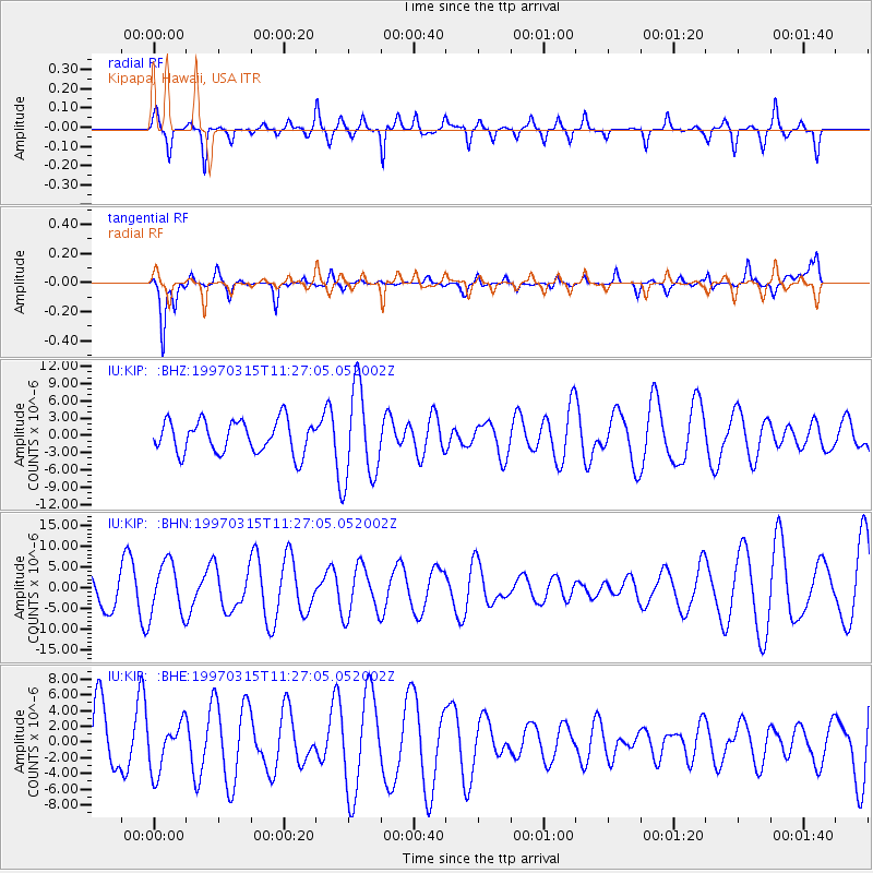
KIP Kipapa, Hawaii, USA - Earthquake Result Viewer
*The percent match for this event was below the threshold and hence no stack was calculated.
| Earthquake location: |
Admiralty Islands Region, P.N.G. |
| Earthquake latitude/longitude: |
-1.4/145.4 |
| Earthquake time(UTC): |
1997/03/15 (074) 11:17:34 GMT |
| Earthquake Depth: |
33 km |
| Earthquake Magnitude: |
5.8 UNKNOWN, 5.4 MS, 5.0 MB |
| Earthquake Catalog/Contributor: |
WHDF/NEIC |
|
| Network: |
IU Global Seismograph Network (GSN - IRIS/USGS) |
| Station: |
KIP Kipapa, Hawaii, USA |
| Lat/Lon: |
21.42 N/158.01 W |
| Elevation: |
70 m |
|
| Distance: |
59.7 deg |
| Az: |
64.192 deg |
| Baz: |
254.997 deg |
| Ray Param: |
$rayparam |
*The percent match for this event was below the threshold and hence was not used in the summary stack. |
|
| Radial Match: |
57.262894 % |
| Radial Bump: |
261 |
| Transverse Match: |
63.72291 % |
| Transverse Bump: |
269 |
| SOD ConfigId: |
4480 |
| Insert Time: |
2010-03-03 16:39:48.673 +0000 |
| GWidth: |
2.5 |
| Max Bumps: |
400 |
| Tol: |
0.001 |
|
Signal To Noise
| Channel | StoN | STA | LTA |
| IU:KIP: :BHN:19970315T11:27:05.052002Z | 1.0250334 | 6.37317E-6 | 6.217524E-6 |
| IU:KIP: :BHE:19970315T11:27:05.052002Z | 0.80636317 | 3.0907984E-6 | 3.8330104E-6 |
| IU:KIP: :BHZ:19970315T11:27:05.052002Z | 2.86105 | 8.042024E-6 | 2.8108648E-6 |
| Arrivals |
| Ps | |
| PpPs | |
| PsPs/PpSs | |


