You are here: Home > Network List > IU - Global Seismograph Network (GSN - IRIS/USGS) Stations List
> Station KIP Kipapa, Hawaii, USA > Earthquake Result Viewer
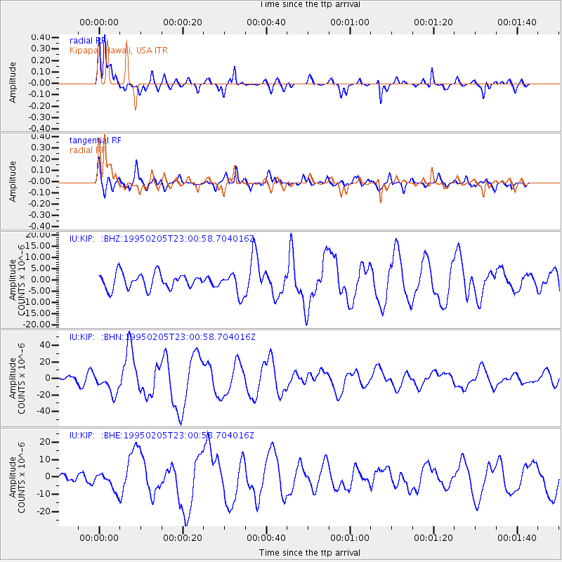
KIP Kipapa, Hawaii, USA - Earthquake Result Viewer
*The percent match for this event was below the threshold and hence no stack was calculated.
| Earthquake location: |
Off E. Coast Of N. Island, N.Z. |
| Earthquake latitude/longitude: |
-37.7/178.8 |
| Earthquake time(UTC): |
1995/02/05 (036) 22:51:10 GMT |
| Earthquake Depth: |
59 km |
| Earthquake Magnitude: |
6.4 MB, 7.1 UNKNOWN, 7.1 MW |
| Earthquake Catalog/Contributor: |
WHDF/NEIC |
|
| Network: |
IU Global Seismograph Network (GSN - IRIS/USGS) |
| Station: |
KIP Kipapa, Hawaii, USA |
| Lat/Lon: |
21.42 N/158.01 W |
| Elevation: |
70 m |
|
| Distance: |
62.7 deg |
| Az: |
24.402 deg |
| Baz: |
200.588 deg |
| Ray Param: |
$rayparam |
*The percent match for this event was below the threshold and hence was not used in the summary stack. |
|
| Radial Match: |
91.422806 % |
| Radial Bump: |
356 |
| Transverse Match: |
80.6206 % |
| Transverse Bump: |
400 |
| SOD ConfigId: |
4480 |
| Insert Time: |
2010-03-03 16:39:56.559 +0000 |
| GWidth: |
2.5 |
| Max Bumps: |
400 |
| Tol: |
0.001 |
|
Signal To Noise
| Channel | StoN | STA | LTA |
| IU:KIP: :BHN:19950205T23:00:58.704016Z | 4.049237 | 1.3249759E-5 | 3.2721623E-6 |
| IU:KIP: :BHE:19950205T23:00:58.704016Z | 2.2070963 | 5.483692E-6 | 2.4845729E-6 |
| IU:KIP: :BHZ:19950205T23:00:58.704016Z | 1.4680463 | 5.000315E-6 | 3.4061015E-6 |
| Arrivals |
| Ps | |
| PpPs | |
| PsPs/PpSs | |


