You are here: Home > Network List > IU - Global Seismograph Network (GSN - IRIS/USGS) Stations List
> Station KIP Kipapa, Hawaii, USA > Earthquake Result Viewer
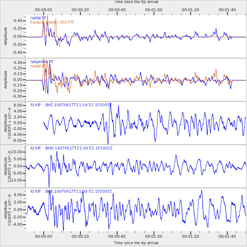
KIP Kipapa, Hawaii, USA - Earthquake Result Viewer
*The percent match for this event was below the threshold and hence no stack was calculated.
| Earthquake location: |
Andreanof Islands, Aleutian Is. |
| Earthquake latitude/longitude: |
51.3/-179.3 |
| Earthquake time(UTC): |
1997/06/17 (168) 21:03:40 GMT |
| Earthquake Depth: |
33 km |
| Earthquake Magnitude: |
6.4 MB, 6.3 MS, 6.4 UNKNOWN, 6.6 ML |
| Earthquake Catalog/Contributor: |
WHDF/NEIC |
|
| Network: |
IU Global Seismograph Network (GSN - IRIS/USGS) |
| Station: |
KIP Kipapa, Hawaii, USA |
| Lat/Lon: |
21.42 N/158.01 W |
| Elevation: |
70 m |
|
| Distance: |
34.2 deg |
| Az: |
142.929 deg |
| Baz: |
336.062 deg |
| Ray Param: |
$rayparam |
*The percent match for this event was below the threshold and hence was not used in the summary stack. |
|
| Radial Match: |
60.73888 % |
| Radial Bump: |
314 |
| Transverse Match: |
47.193047 % |
| Transverse Bump: |
387 |
| SOD ConfigId: |
4480 |
| Insert Time: |
2010-03-03 16:40:10.718 +0000 |
| GWidth: |
2.5 |
| Max Bumps: |
400 |
| Tol: |
0.001 |
|
Signal To Noise
| Channel | StoN | STA | LTA |
| IU:KIP: :BHN:19970617T21:09:52.153003Z | 3.6729572 | 4.710065E-6 | 1.2823631E-6 |
| IU:KIP: :BHE:19970617T21:09:52.153003Z | 2.1811533 | 2.3416908E-6 | 1.0736022E-6 |
| IU:KIP: :BHZ:19970617T21:09:52.153003Z | 1.3527477 | 1.8461355E-6 | 1.3647302E-6 |
| Arrivals |
| Ps | |
| PpPs | |
| PsPs/PpSs | |


