You are here: Home > Network List > IU - Global Seismograph Network (GSN - IRIS/USGS) Stations List
> Station KIP Kipapa, Hawaii, USA > Earthquake Result Viewer
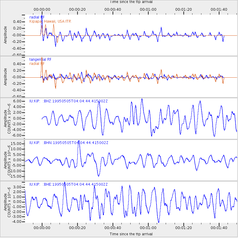
KIP Kipapa, Hawaii, USA - Earthquake Result Viewer
*The percent match for this event was below the threshold and hence no stack was calculated.
| Earthquake location: |
Samar, Philippines |
| Earthquake latitude/longitude: |
12.6/125.3 |
| Earthquake time(UTC): |
1995/05/05 (125) 03:53:47 GMT |
| Earthquake Depth: |
33 km |
| Earthquake Magnitude: |
6.2 MB, 7.0 MS, 7.1 UNKNOWN, 7.0 MW |
| Earthquake Catalog/Contributor: |
WHDF/NEIC |
|
| Network: |
IU Global Seismograph Network (GSN - IRIS/USGS) |
| Station: |
KIP Kipapa, Hawaii, USA |
| Lat/Lon: |
21.42 N/158.01 W |
| Elevation: |
70 m |
|
| Distance: |
73.2 deg |
| Az: |
71.246 deg |
| Baz: |
277.235 deg |
| Ray Param: |
$rayparam |
*The percent match for this event was below the threshold and hence was not used in the summary stack. |
|
| Radial Match: |
75.009 % |
| Radial Bump: |
400 |
| Transverse Match: |
54.017925 % |
| Transverse Bump: |
400 |
| SOD ConfigId: |
4480 |
| Insert Time: |
2010-03-03 16:40:18.745 +0000 |
| GWidth: |
2.5 |
| Max Bumps: |
400 |
| Tol: |
0.001 |
|
Signal To Noise
| Channel | StoN | STA | LTA |
| IU:KIP: :BHN:19950505T04:04:44.415002Z | 1.5423999 | 2.0696393E-6 | 1.3418305E-6 |
| IU:KIP: :BHE:19950505T04:04:44.415002Z | 0.43173245 | 6.535991E-7 | 1.5138985E-6 |
| IU:KIP: :BHZ:19950505T04:04:44.415002Z | 2.532102 | 3.880199E-6 | 1.5324024E-6 |
| Arrivals |
| Ps | |
| PpPs | |
| PsPs/PpSs | |


