You are here: Home > Network List > IU - Global Seismograph Network (GSN - IRIS/USGS) Stations List
> Station KIP Kipapa, Hawaii, USA > Earthquake Result Viewer
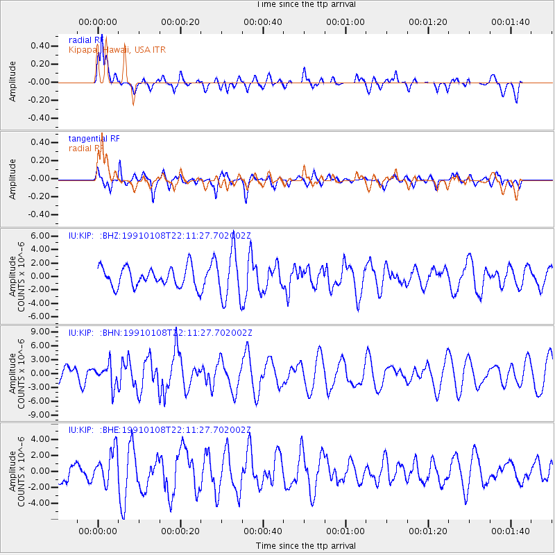
KIP Kipapa, Hawaii, USA - Earthquake Result Viewer
*The percent match for this event was below the threshold and hence no stack was calculated.
| Earthquake location: |
Tonga Islands |
| Earthquake latitude/longitude: |
-18.0/-173.7 |
| Earthquake time(UTC): |
1991/01/08 (008) 22:04:10 GMT |
| Earthquake Depth: |
43 km |
| Earthquake Magnitude: |
6.1 MB, 6.0 MS, 6.3 UNKNOWN |
| Earthquake Catalog/Contributor: |
WHDF/NEIC |
|
| Network: |
IU Global Seismograph Network (GSN - IRIS/USGS) |
| Station: |
KIP Kipapa, Hawaii, USA |
| Lat/Lon: |
21.42 N/158.01 W |
| Elevation: |
70 m |
|
| Distance: |
42.1 deg |
| Az: |
22.018 deg |
| Baz: |
202.512 deg |
| Ray Param: |
$rayparam |
*The percent match for this event was below the threshold and hence was not used in the summary stack. |
|
| Radial Match: |
70.23925 % |
| Radial Bump: |
400 |
| Transverse Match: |
71.02421 % |
| Transverse Bump: |
400 |
| SOD ConfigId: |
4480 |
| Insert Time: |
2010-03-03 16:40:34.977 +0000 |
| GWidth: |
2.5 |
| Max Bumps: |
400 |
| Tol: |
0.001 |
|
Signal To Noise
| Channel | StoN | STA | LTA |
| IU:KIP: :BHN:19910108T22:11:27.702002Z | 0.87916017 | 2.3852012E-6 | 2.7130452E-6 |
| IU:KIP: :BHE:19910108T22:11:27.702002Z | 1.0976453 | 2.138764E-6 | 1.948502E-6 |
| IU:KIP: :BHZ:19910108T22:11:27.702002Z | 2.5490563 | 3.631328E-6 | 1.4245775E-6 |
| Arrivals |
| Ps | |
| PpPs | |
| PsPs/PpSs | |


