You are here: Home > Network List > IU - Global Seismograph Network (GSN - IRIS/USGS) Stations List
> Station KIP Kipapa, Hawaii, USA > Earthquake Result Viewer
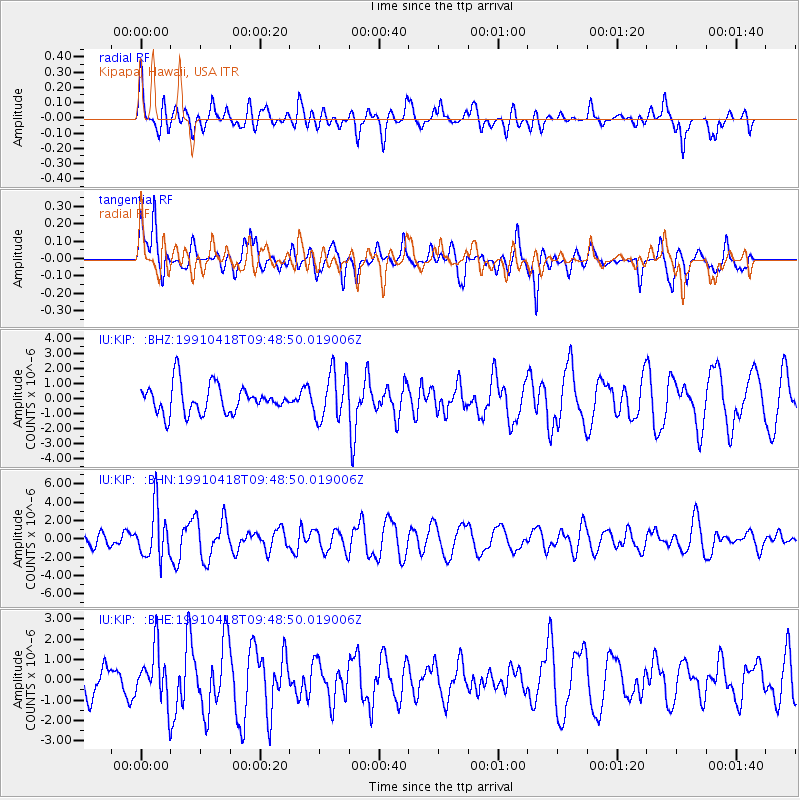
KIP Kipapa, Hawaii, USA - Earthquake Result Viewer
*The percent match for this event was below the threshold and hence no stack was calculated.
| Earthquake location: |
South Of Fiji Islands |
| Earthquake latitude/longitude: |
-22.8/-179.4 |
| Earthquake time(UTC): |
1991/04/18 (108) 09:41:20 GMT |
| Earthquake Depth: |
474 km |
| Earthquake Magnitude: |
5.7 MB |
| Earthquake Catalog/Contributor: |
WHDF/NEIC |
|
| Network: |
IU Global Seismograph Network (GSN - IRIS/USGS) |
| Station: |
KIP Kipapa, Hawaii, USA |
| Lat/Lon: |
21.42 N/158.01 W |
| Elevation: |
70 m |
|
| Distance: |
48.7 deg |
| Az: |
26.939 deg |
| Baz: |
206.65 deg |
| Ray Param: |
$rayparam |
*The percent match for this event was below the threshold and hence was not used in the summary stack. |
|
| Radial Match: |
53.53456 % |
| Radial Bump: |
400 |
| Transverse Match: |
54.27335 % |
| Transverse Bump: |
400 |
| SOD ConfigId: |
4480 |
| Insert Time: |
2010-03-03 16:40:45.800 +0000 |
| GWidth: |
2.5 |
| Max Bumps: |
400 |
| Tol: |
0.001 |
|
Signal To Noise
| Channel | StoN | STA | LTA |
| IU:KIP: :BHN:19910418T09:48:50.019006Z | 1.9767935 | 2.7184617E-6 | 1.3751875E-6 |
| IU:KIP: :BHE:19910418T09:48:50.019006Z | 1.7027466 | 1.3300546E-6 | 7.8112305E-7 |
| IU:KIP: :BHZ:19910418T09:48:50.019006Z | 1.7070806 | 1.5918675E-6 | 9.325087E-7 |
| Arrivals |
| Ps | |
| PpPs | |
| PsPs/PpSs | |


