You are here: Home > Network List > US - United States National Seismic Network Stations List
> Station MSO Missoula, Montana, USA > Earthquake Result Viewer
MSO Missoula, Montana, USA - Earthquake Result Viewer
*The percent match for this event was below the threshold and hence no stack was calculated.
| Earthquake location: |
Northern Colombia |
| Earthquake latitude/longitude: |
6.8/-73.0 |
| Earthquake time(UTC): |
2015/03/10 (069) 20:55:43 GMT |
| Earthquake Depth: |
147 km |
| Earthquake Magnitude: |
6.2 MWB |
| Earthquake Catalog/Contributor: |
NEIC PDE/NEIC COMCAT |
|
| Network: |
US United States National Seismic Network |
| Station: |
MSO Missoula, Montana, USA |
| Lat/Lon: |
46.83 N/113.94 W |
| Elevation: |
1264 m |
|
| Distance: |
53.1 deg |
| Az: |
325.751 deg |
| Baz: |
125.519 deg |
| Ray Param: |
$rayparam |
*The percent match for this event was below the threshold and hence was not used in the summary stack. |
|
| Radial Match: |
73.30943 % |
| Radial Bump: |
400 |
| Transverse Match: |
66.50867 % |
| Transverse Bump: |
400 |
| SOD ConfigId: |
872571 |
| Insert Time: |
2015-03-24 21:20:28.091 +0000 |
| GWidth: |
2.5 |
| Max Bumps: |
400 |
| Tol: |
0.001 |
|
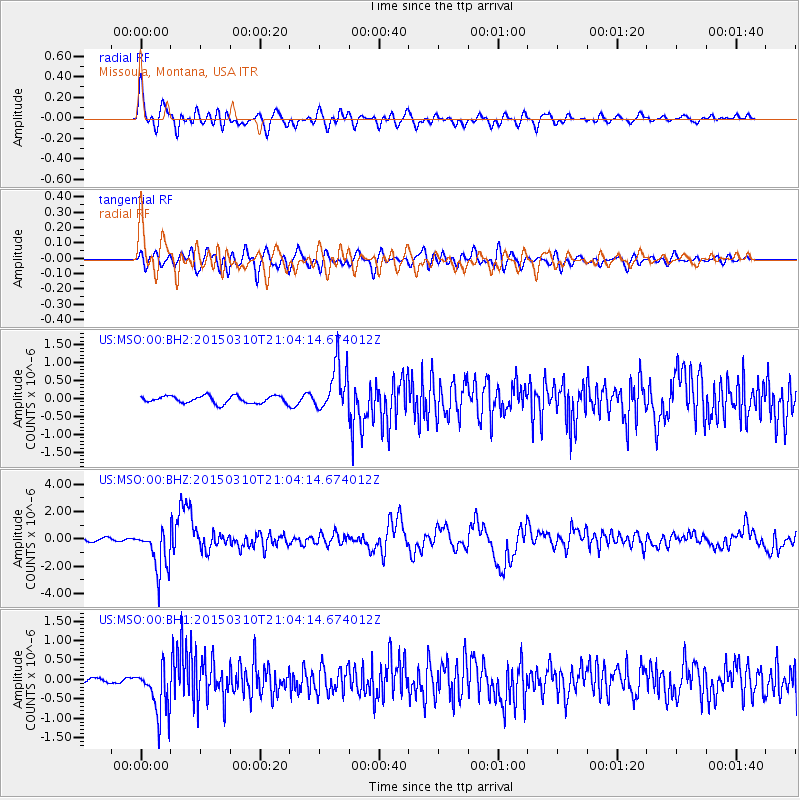
Signal To Noise
| Channel | StoN | STA | LTA |
| US:MSO:00:BHZ:20150310T21:04:14.674012Z | 13.139714 | 1.5964404E-6 | 1.2149735E-7 |
| US:MSO:00:BH1:20150310T21:04:14.674012Z | 12.469573 | 6.239402E-7 | 5.0037016E-8 |
| US:MSO:00:BH2:20150310T21:04:14.674012Z | 6.5045176 | 6.669493E-7 | 1.02536326E-7 |
| Arrivals |
| Ps | |
| PpPs | |
| PsPs/PpSs | |


