You are here: Home > Network List > IU - Global Seismograph Network (GSN - IRIS/USGS) Stations List
> Station KIP Kipapa, Hawaii, USA > Earthquake Result Viewer
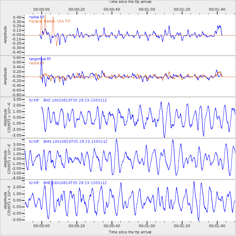
KIP Kipapa, Hawaii, USA - Earthquake Result Viewer
*The percent match for this event was below the threshold and hence no stack was calculated.
| Earthquake location: |
Fiji Islands Region |
| Earthquake latitude/longitude: |
-20.7/-177.8 |
| Earthquake time(UTC): |
1991/08/29 (241) 05:21:12 GMT |
| Earthquake Depth: |
379 km |
| Earthquake Magnitude: |
5.5 UNKNOWN, 5.4 MB |
| Earthquake Catalog/Contributor: |
WHDF/NEIC |
|
| Network: |
IU Global Seismograph Network (GSN - IRIS/USGS) |
| Station: |
KIP Kipapa, Hawaii, USA |
| Lat/Lon: |
21.42 N/158.01 W |
| Elevation: |
70 m |
|
| Distance: |
46.1 deg |
| Az: |
25.929 deg |
| Baz: |
206.071 deg |
| Ray Param: |
$rayparam |
*The percent match for this event was below the threshold and hence was not used in the summary stack. |
|
| Radial Match: |
46.418015 % |
| Radial Bump: |
400 |
| Transverse Match: |
67.026436 % |
| Transverse Bump: |
400 |
| SOD ConfigId: |
4480 |
| Insert Time: |
2010-03-03 16:41:20.357 +0000 |
| GWidth: |
2.5 |
| Max Bumps: |
400 |
| Tol: |
0.001 |
|
Signal To Noise
| Channel | StoN | STA | LTA |
| IU:KIP: :BHN:19910829T05:28:29.136011Z | 1.3277155 | 1.4239057E-6 | 1.0724478E-6 |
| IU:KIP: :BHE:19910829T05:28:29.136011Z | 2.1476927 | 1.5663136E-6 | 7.2930067E-7 |
| IU:KIP: :BHZ:19910829T05:28:29.136011Z | 1.0726995 | 1.052222E-6 | 9.809104E-7 |
| Arrivals |
| Ps | |
| PpPs | |
| PsPs/PpSs | |


