You are here: Home > Network List > US - United States National Seismic Network Stations List
> Station MSO Missoula, Montana, USA > Earthquake Result Viewer
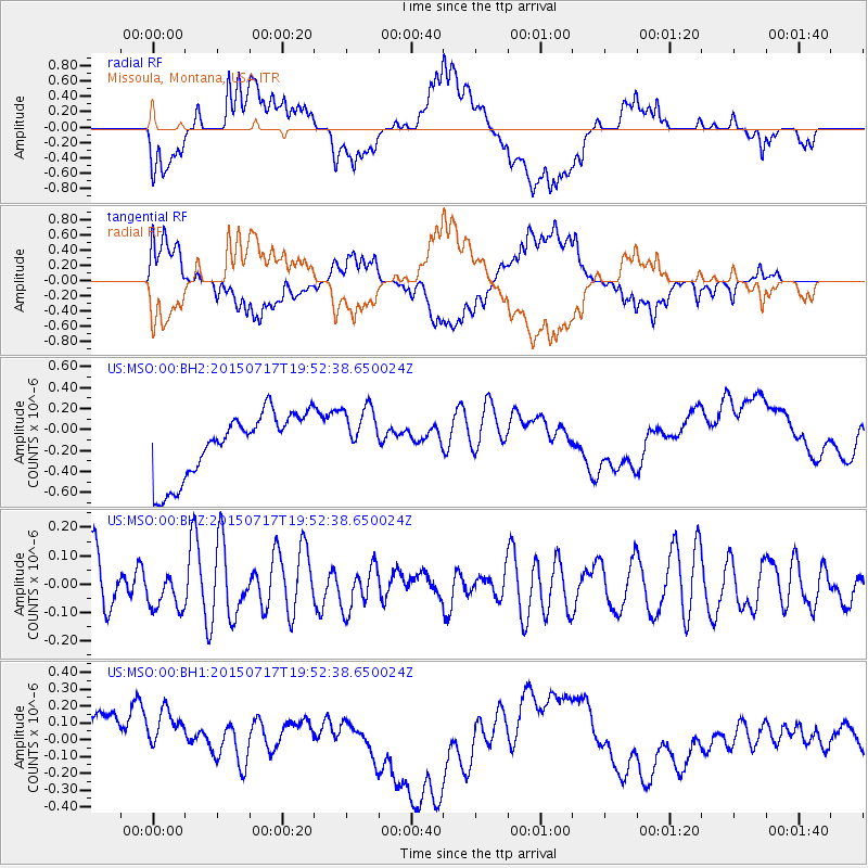
MSO Missoula, Montana, USA - Earthquake Result Viewer
*The percent match for this event was below the threshold and hence no stack was calculated.
| Earthquake location: |
New Britain Region, P.N.G. |
| Earthquake latitude/longitude: |
-5.5/152.0 |
| Earthquake time(UTC): |
2015/07/17 (198) 19:39:44 GMT |
| Earthquake Depth: |
49 km |
| Earthquake Magnitude: |
5.1 MW |
| Earthquake Catalog/Contributor: |
ISC/ISC |
|
| Network: |
US United States National Seismic Network |
| Station: |
MSO Missoula, Montana, USA |
| Lat/Lon: |
46.83 N/113.94 W |
| Elevation: |
1264 m |
|
| Distance: |
96.8 deg |
| Az: |
43.605 deg |
| Baz: |
269.183 deg |
| Ray Param: |
$rayparam |
*The percent match for this event was below the threshold and hence was not used in the summary stack. |
|
| Radial Match: |
33.461758 % |
| Radial Bump: |
400 |
| Transverse Match: |
31.03078 % |
| Transverse Bump: |
400 |
| SOD ConfigId: |
7422571 |
| Insert Time: |
2019-04-19 21:06:01.180 +0000 |
| GWidth: |
2.5 |
| Max Bumps: |
400 |
| Tol: |
0.001 |
|
Signal To Noise
| Channel | StoN | STA | LTA |
| US:MSO:00:BHZ:20150717T19:52:38.650024Z | 0.82091355 | 6.7202386E-8 | 8.186293E-8 |
| US:MSO:00:BH1:20150717T19:52:38.650024Z | 0.8693746 | 2.4447277E-7 | 2.8120536E-7 |
| US:MSO:00:BH2:20150717T19:52:38.650024Z | 0.8833713 | 2.7290832E-7 | 3.0893955E-7 |
| Arrivals |
| Ps | |
| PpPs | |
| PsPs/PpSs | |


