You are here: Home > Network List > IU - Global Seismograph Network (GSN - IRIS/USGS) Stations List
> Station KIP Kipapa, Hawaii, USA > Earthquake Result Viewer
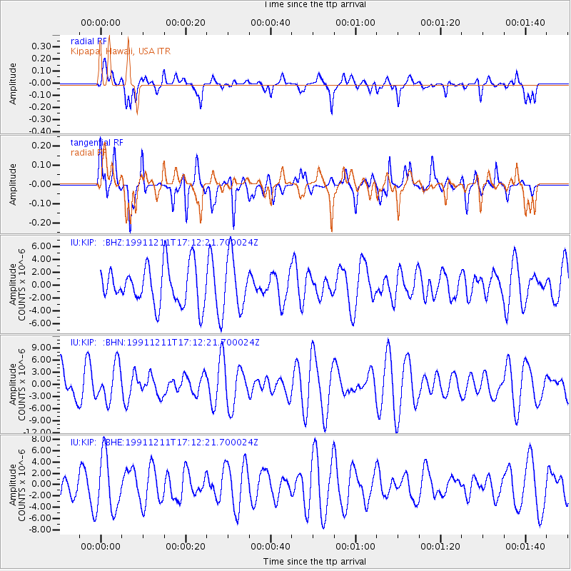
KIP Kipapa, Hawaii, USA - Earthquake Result Viewer
*The percent match for this event was below the threshold and hence no stack was calculated.
| Earthquake location: |
Southern East Pacific Rise |
| Earthquake latitude/longitude: |
-17.8/-116.0 |
| Earthquake time(UTC): |
1991/12/11 (345) 17:03:09 GMT |
| Earthquake Depth: |
10 km |
| Earthquake Magnitude: |
5.9 MB, 6.1 MS |
| Earthquake Catalog/Contributor: |
WHDF/NEIC |
|
| Network: |
IU Global Seismograph Network (GSN - IRIS/USGS) |
| Station: |
KIP Kipapa, Hawaii, USA |
| Lat/Lon: |
21.42 N/158.01 W |
| Elevation: |
70 m |
|
| Distance: |
56.7 deg |
| Az: |
311.763 deg |
| Baz: |
130.304 deg |
| Ray Param: |
$rayparam |
*The percent match for this event was below the threshold and hence was not used in the summary stack. |
|
| Radial Match: |
52.862404 % |
| Radial Bump: |
400 |
| Transverse Match: |
57.629646 % |
| Transverse Bump: |
400 |
| SOD ConfigId: |
4480 |
| Insert Time: |
2010-03-03 16:41:25.414 +0000 |
| GWidth: |
2.5 |
| Max Bumps: |
400 |
| Tol: |
0.001 |
|
Signal To Noise
| Channel | StoN | STA | LTA |
| IU:KIP: :BHN:19911211T17:12:21.700024Z | 0.7991555 | 4.494484E-6 | 5.6240424E-6 |
| IU:KIP: :BHE:19911211T17:12:21.700024Z | 2.3482172 | 4.9155337E-6 | 2.0933044E-6 |
| IU:KIP: :BHZ:19911211T17:12:21.700024Z | 1.3328829 | 4.0164987E-6 | 3.013392E-6 |
| Arrivals |
| Ps | |
| PpPs | |
| PsPs/PpSs | |


