You are here: Home > Network List > TA - USArray Transportable Network (new EarthScope stations) Stations List
> Station N23A Red Feather Lakes, CO, USA > Earthquake Result Viewer
N23A Red Feather Lakes, CO, USA - Earthquake Result Viewer

| Earthquake location: |
Santa Cruz Islands |
| Earthquake latitude/longitude: |
-10.4/165.2 |
| Earthquake time(UTC): |
2015/07/18 (199) 02:27:33 GMT |
| Earthquake Depth: |
10 km |
| Earthquake Magnitude: |
7.0 MWW, 7.5 MI |
| Earthquake Catalog/Contributor: |
NEIC PDE/NEIC COMCAT |
|
| Network: |
TA USArray Transportable Network (new EarthScope stations) |
| Station: |
N23A Red Feather Lakes, CO, USA |
| Lat/Lon: |
40.89 N/105.94 W |
| Elevation: |
2458 m |
|
| Distance: |
95.9 deg |
| Az: |
49.64 deg |
| Baz: |
261.384 deg |
| Ray Param: |
0.040657513 |
| Estimated Moho Depth: |
63.75 km |
| Estimated Crust Vp/Vs: |
2.05 |
| Assumed Crust Vp: |
6.306 km/s |
| Estimated Crust Vs: |
3.08 km/s |
| Estimated Crust Poisson's Ratio: |
0.34 |
|
| Radial Match: |
88.92995 % |
| Radial Bump: |
400 |
| Transverse Match: |
69.06548 % |
| Transverse Bump: |
400 |
| SOD ConfigId: |
7422571 |
| Insert Time: |
2019-04-19 21:19:40.570 +0000 |
| GWidth: |
2.5 |
| Max Bumps: |
400 |
| Tol: |
0.001 |
|
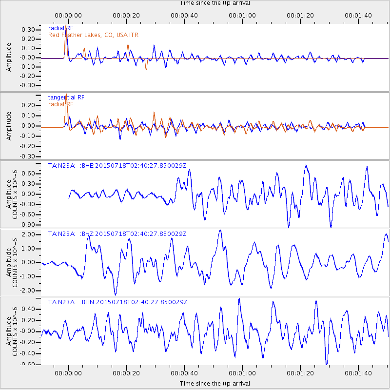
Signal To Noise
| Channel | StoN | STA | LTA |
| TA:N23A: :BHZ:20150718T02:40:27.850029Z | 5.825231 | 5.751957E-7 | 9.8742134E-8 |
| TA:N23A: :BHN:20150718T02:40:27.850029Z | 0.6048219 | 8.892026E-8 | 1.4701891E-7 |
| TA:N23A: :BHE:20150718T02:40:27.850029Z | 2.0347922 | 1.6685149E-7 | 8.1999275E-8 |
| Arrivals |
| Ps | 11 SECOND |
| PpPs | 30 SECOND |
| PsPs/PpSs | 41 SECOND |


