You are here: Home > Network List > GS - US Geological Survey Networks Stations List
> Station KAN13 Rinehart Farm > Earthquake Result Viewer
KAN13 Rinehart Farm - Earthquake Result Viewer
*The percent match for this event was below the threshold and hence no stack was calculated.
| Earthquake location: |
Southern East Pacific Rise |
| Earthquake latitude/longitude: |
-35.5/-105.1 |
| Earthquake time(UTC): |
2015/07/20 (201) 11:08:18 GMT |
| Earthquake Depth: |
13 km |
| Earthquake Magnitude: |
5.8 MW |
| Earthquake Catalog/Contributor: |
ISC/ISC |
|
| Network: |
GS US Geological Survey Networks |
| Station: |
KAN13 Rinehart Farm |
| Lat/Lon: |
37.01 N/97.48 W |
| Elevation: |
340 m |
|
| Distance: |
72.5 deg |
| Az: |
6.385 deg |
| Baz: |
186.511 deg |
| Ray Param: |
$rayparam |
*The percent match for this event was below the threshold and hence was not used in the summary stack. |
|
| Radial Match: |
47.95353 % |
| Radial Bump: |
400 |
| Transverse Match: |
47.85331 % |
| Transverse Bump: |
400 |
| SOD ConfigId: |
7422571 |
| Insert Time: |
2019-04-19 21:38:01.386 +0000 |
| GWidth: |
2.5 |
| Max Bumps: |
400 |
| Tol: |
0.001 |
|
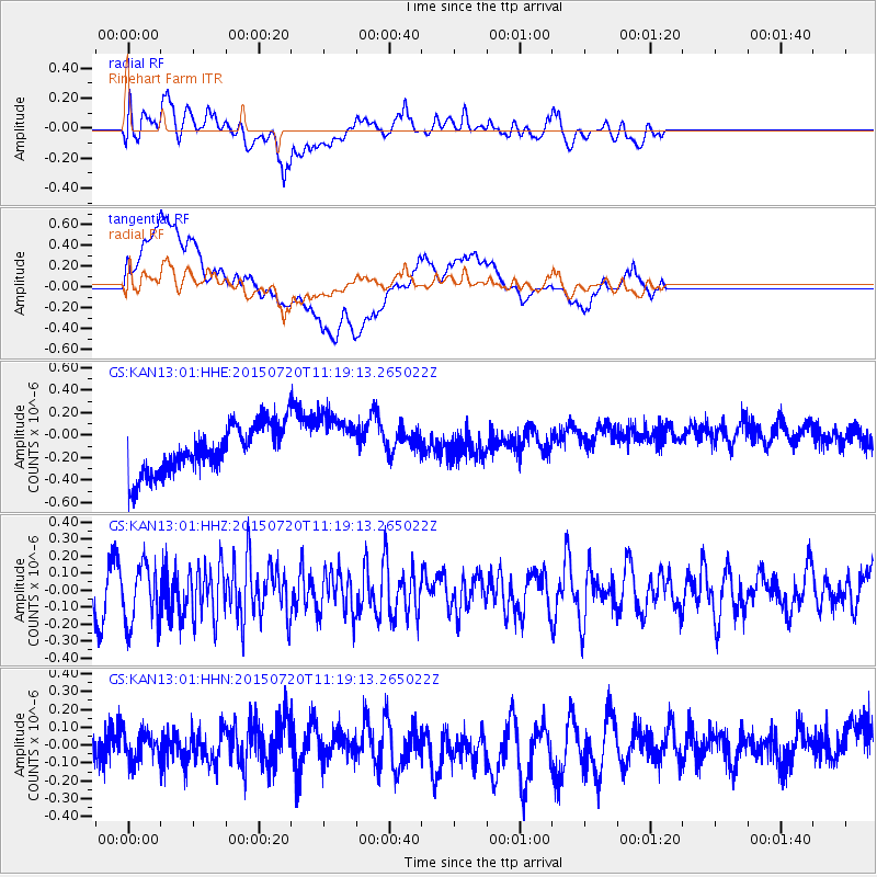
Signal To Noise
| Channel | StoN | STA | LTA |
| GS:KAN13:01:HHZ:20150720T11:19:13.265022Z | 2.4252057 | 1.67404E-7 | 6.902672E-8 |
| GS:KAN13:01:HHN:20150720T11:19:13.265022Z | 0.69882154 | 7.942903E-8 | 1.1366139E-7 |
| GS:KAN13:01:HHE:20150720T11:19:13.265022Z | 1.2550534 | 2.678912E-7 | 2.1345005E-7 |
| Arrivals |
| Ps | |
| PpPs | |
| PsPs/PpSs | |


