You are here: Home > Network List > US - United States National Seismic Network Stations List
> Station MSO Missoula, Montana, USA > Earthquake Result Viewer
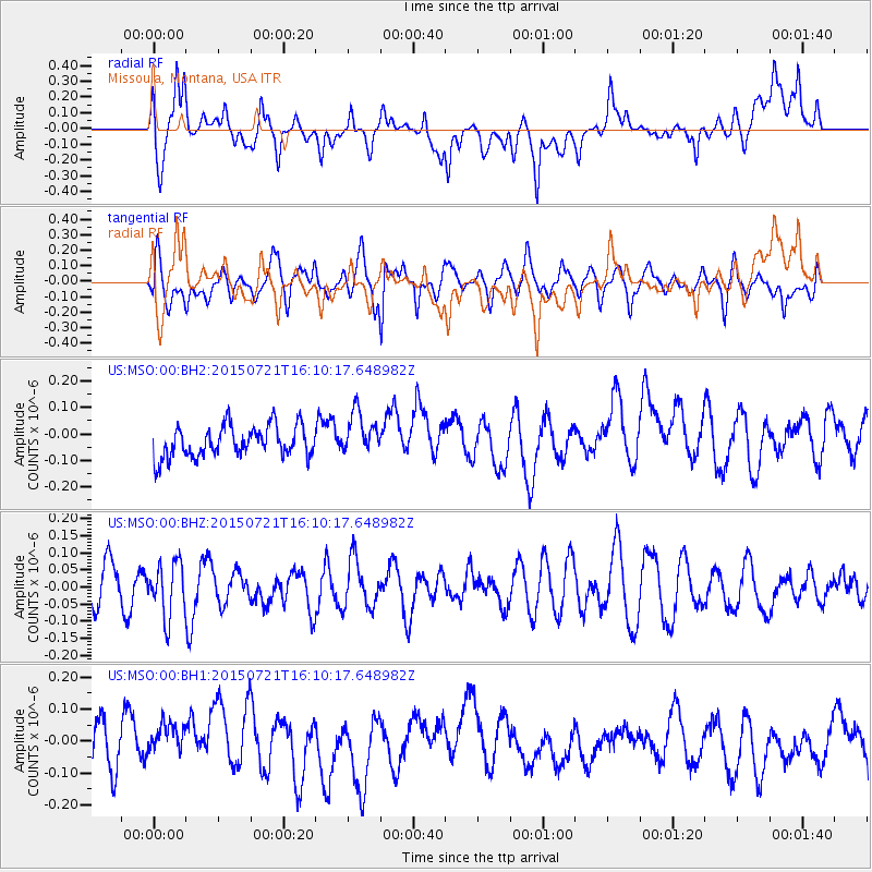
MSO Missoula, Montana, USA - Earthquake Result Viewer
*The percent match for this event was below the threshold and hence no stack was calculated.
| Earthquake location: |
Tonga Islands |
| Earthquake latitude/longitude: |
-20.5/-175.2 |
| Earthquake time(UTC): |
2015/07/21 (202) 15:58:04 GMT |
| Earthquake Depth: |
10 km |
| Earthquake Magnitude: |
5.3 MW |
| Earthquake Catalog/Contributor: |
ISC/ISC |
|
| Network: |
US United States National Seismic Network |
| Station: |
MSO Missoula, Montana, USA |
| Lat/Lon: |
46.83 N/113.94 W |
| Elevation: |
1264 m |
|
| Distance: |
86.8 deg |
| Az: |
37.087 deg |
| Baz: |
235.414 deg |
| Ray Param: |
$rayparam |
*The percent match for this event was below the threshold and hence was not used in the summary stack. |
|
| Radial Match: |
46.147152 % |
| Radial Bump: |
400 |
| Transverse Match: |
57.04427 % |
| Transverse Bump: |
400 |
| SOD ConfigId: |
7422571 |
| Insert Time: |
2019-04-19 21:51:54.175 +0000 |
| GWidth: |
2.5 |
| Max Bumps: |
400 |
| Tol: |
0.001 |
|
Signal To Noise
| Channel | StoN | STA | LTA |
| US:MSO:00:BHZ:20150721T16:10:17.648982Z | 1.4505783 | 7.893345E-8 | 5.441516E-8 |
| US:MSO:00:BH1:20150721T16:10:17.648982Z | 0.9425649 | 6.477849E-8 | 6.872576E-8 |
| US:MSO:00:BH2:20150721T16:10:17.648982Z | 1.348677 | 7.970408E-8 | 5.9097975E-8 |
| Arrivals |
| Ps | |
| PpPs | |
| PsPs/PpSs | |


