You are here: Home > Network List > UW - Pacific Northwest Regional Seismic Network Stations List
> Station PASS Maple Falls, WA, USA > Earthquake Result Viewer
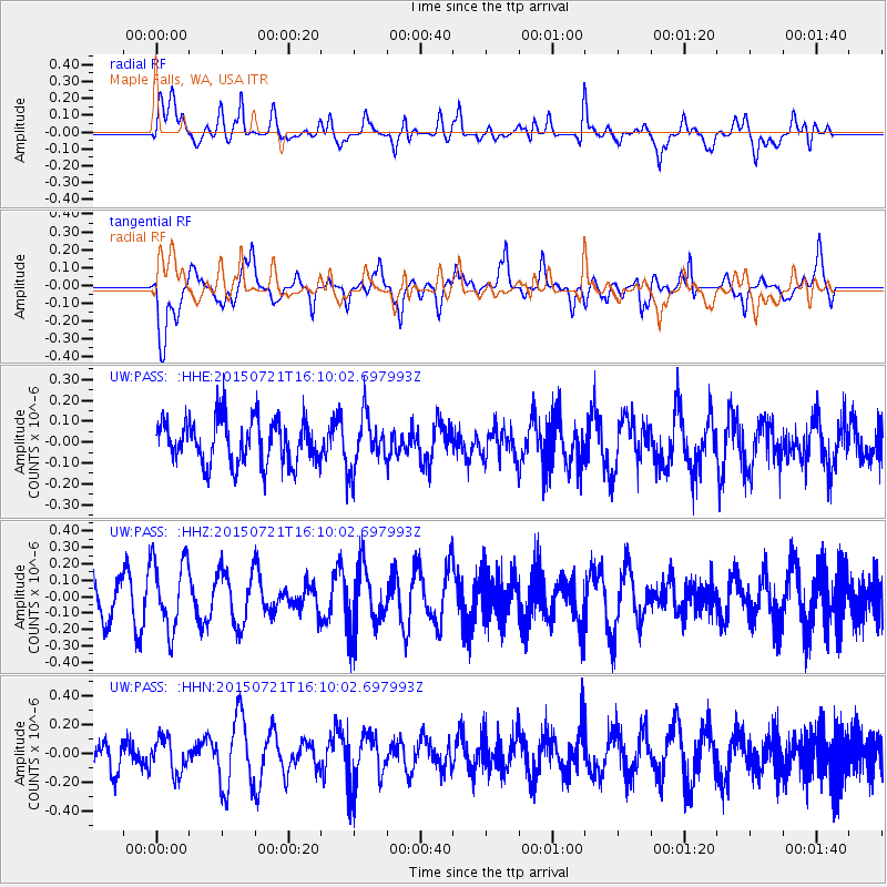
PASS Maple Falls, WA, USA - Earthquake Result Viewer
*The percent match for this event was below the threshold and hence no stack was calculated.
| Earthquake location: |
Tonga Islands |
| Earthquake latitude/longitude: |
-20.5/-175.2 |
| Earthquake time(UTC): |
2015/07/21 (202) 15:58:04 GMT |
| Earthquake Depth: |
10 km |
| Earthquake Magnitude: |
5.3 MW |
| Earthquake Catalog/Contributor: |
ISC/ISC |
|
| Network: |
UW Pacific Northwest Regional Seismic Network |
| Station: |
PASS Maple Falls, WA, USA |
| Lat/Lon: |
49.00 N/122.09 W |
| Elevation: |
174 m |
|
| Distance: |
83.8 deg |
| Az: |
32.002 deg |
| Baz: |
228.963 deg |
| Ray Param: |
$rayparam |
*The percent match for this event was below the threshold and hence was not used in the summary stack. |
|
| Radial Match: |
51.36538 % |
| Radial Bump: |
400 |
| Transverse Match: |
57.312153 % |
| Transverse Bump: |
400 |
| SOD ConfigId: |
7422571 |
| Insert Time: |
2019-04-19 21:52:11.075 +0000 |
| GWidth: |
2.5 |
| Max Bumps: |
400 |
| Tol: |
0.001 |
|
Signal To Noise
| Channel | StoN | STA | LTA |
| UW:PASS: :HHZ:20150721T16:10:02.697993Z | 1.4946538 | 2.1115042E-7 | 1.4127046E-7 |
| UW:PASS: :HHN:20150721T16:10:02.697993Z | 0.8910205 | 1.2297568E-7 | 1.3801667E-7 |
| UW:PASS: :HHE:20150721T16:10:02.697993Z | 1.1808785 | 1.2541533E-7 | 1.06205114E-7 |
| Arrivals |
| Ps | |
| PpPs | |
| PsPs/PpSs | |


