You are here: Home > Network List > GS - US Geological Survey Networks Stations List
> Station KAN13 Rinehart Farm > Earthquake Result Viewer
KAN13 Rinehart Farm - Earthquake Result Viewer
*The percent match for this event was below the threshold and hence no stack was calculated.
| Earthquake location: |
Kuril Islands |
| Earthquake latitude/longitude: |
44.3/148.1 |
| Earthquake time(UTC): |
2015/07/22 (203) 06:03:56 GMT |
| Earthquake Depth: |
106 km |
| Earthquake Magnitude: |
3.7 mb |
| Earthquake Catalog/Contributor: |
ISC/ISC |
|
| Network: |
GS US Geological Survey Networks |
| Station: |
KAN13 Rinehart Farm |
| Lat/Lon: |
37.01 N/97.48 W |
| Elevation: |
340 m |
|
| Distance: |
79.7 deg |
| Az: |
47.792 deg |
| Baz: |
318.358 deg |
| Ray Param: |
$rayparam |
*The percent match for this event was below the threshold and hence was not used in the summary stack. |
|
| Radial Match: |
38.74893 % |
| Radial Bump: |
400 |
| Transverse Match: |
44.193375 % |
| Transverse Bump: |
400 |
| SOD ConfigId: |
7422571 |
| Insert Time: |
2019-04-19 22:00:27.852 +0000 |
| GWidth: |
2.5 |
| Max Bumps: |
400 |
| Tol: |
0.001 |
|
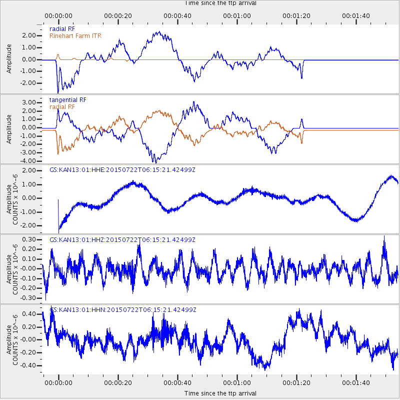
Signal To Noise
| Channel | StoN | STA | LTA |
| GS:KAN13:01:HHZ:20150722T06:15:21.42499Z | 0.93659693 | 7.3186015E-8 | 7.814036E-8 |
| GS:KAN13:01:HHN:20150722T06:15:21.42499Z | 0.97775465 | 1.6612894E-7 | 1.6990862E-7 |
| GS:KAN13:01:HHE:20150722T06:15:21.42499Z | 0.77649814 | 6.2757215E-7 | 8.0820814E-7 |
| Arrivals |
| Ps | |
| PpPs | |
| PsPs/PpSs | |


