You are here: Home > Network List > TA - USArray Transportable Network (new EarthScope stations) Stations List
> Station X43A Marvell, AR, USA > Earthquake Result Viewer
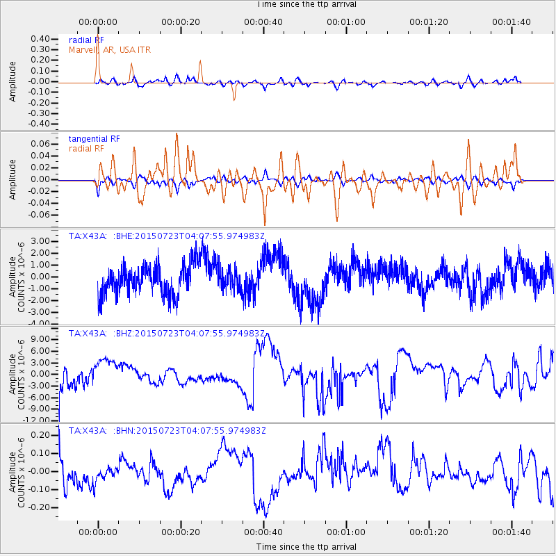
X43A Marvell, AR, USA - Earthquake Result Viewer
*The percent match for this event was below the threshold and hence no stack was calculated.
| Earthquake location: |
Central Mid-Atlantic Ridge |
| Earthquake latitude/longitude: |
-0.7/-21.1 |
| Earthquake time(UTC): |
2015/07/23 (204) 03:56:52 GMT |
| Earthquake Depth: |
10 km |
| Earthquake Magnitude: |
5.6 MW |
| Earthquake Catalog/Contributor: |
ISC/ISC |
|
| Network: |
TA USArray Transportable Network (new EarthScope stations) |
| Station: |
X43A Marvell, AR, USA |
| Lat/Lon: |
34.52 N/90.88 W |
| Elevation: |
53 m |
|
| Distance: |
73.8 deg |
| Az: |
306.231 deg |
| Baz: |
102.361 deg |
| Ray Param: |
$rayparam |
*The percent match for this event was below the threshold and hence was not used in the summary stack. |
|
| Radial Match: |
44.432465 % |
| Radial Bump: |
400 |
| Transverse Match: |
47.94408 % |
| Transverse Bump: |
400 |
| SOD ConfigId: |
7422571 |
| Insert Time: |
2019-04-19 22:11:56.155 +0000 |
| GWidth: |
2.5 |
| Max Bumps: |
400 |
| Tol: |
0.001 |
|
Signal To Noise
| Channel | StoN | STA | LTA |
| TA:X43A: :BHZ:20150723T04:07:55.974983Z | 1.7215949 | 4.902608E-6 | 2.8477127E-6 |
| TA:X43A: :BHN:20150723T04:07:55.974983Z | 0.6853651 | 4.852836E-8 | 7.0806585E-8 |
| TA:X43A: :BHE:20150723T04:07:55.974983Z | 0.68953913 | 8.671195E-7 | 1.2575349E-6 |
| Arrivals |
| Ps | |
| PpPs | |
| PsPs/PpSs | |


