You are here: Home > Network List > TA - USArray Transportable Network (new EarthScope stations) Stations List
> Station Z41A Richland Creek Farm, El Dorado, AR, USA > Earthquake Result Viewer
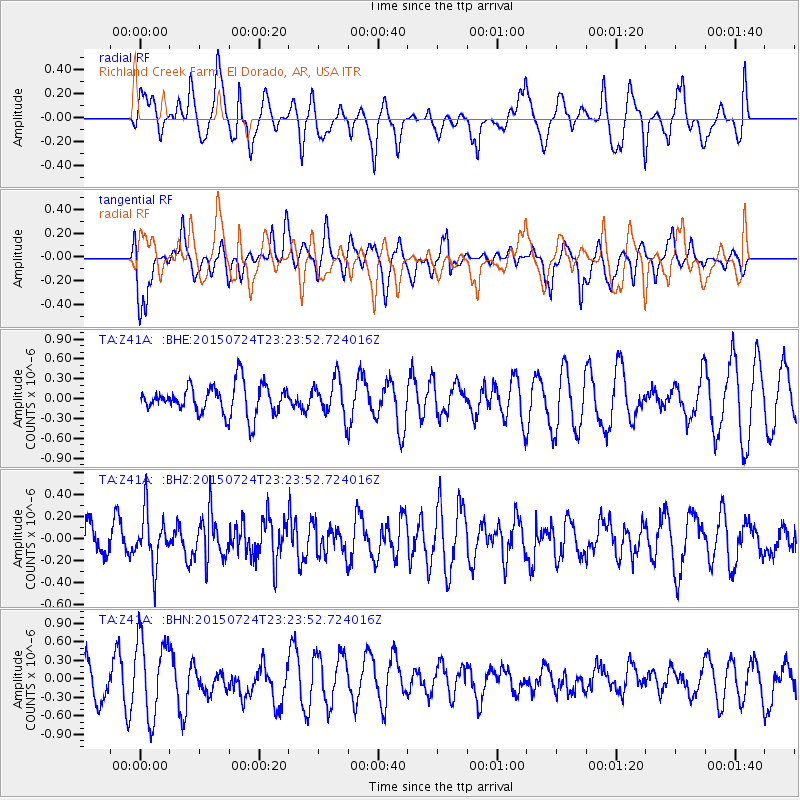
Z41A Richland Creek Farm, El Dorado, AR, USA - Earthquake Result Viewer
*The percent match for this event was below the threshold and hence no stack was calculated.
| Earthquake location: |
Near Coast Of Northern Chile |
| Earthquake latitude/longitude: |
-20.3/-70.3 |
| Earthquake time(UTC): |
2015/07/24 (205) 23:14:38 GMT |
| Earthquake Depth: |
34 km |
| Earthquake Magnitude: |
5.5 MB |
| Earthquake Catalog/Contributor: |
NEIC PDE/NEIC COMCAT |
|
| Network: |
TA USArray Transportable Network (new EarthScope stations) |
| Station: |
Z41A Richland Creek Farm, El Dorado, AR, USA |
| Lat/Lon: |
33.26 N/92.80 W |
| Elevation: |
62 m |
|
| Distance: |
57.4 deg |
| Az: |
337.6 deg |
| Baz: |
154.729 deg |
| Ray Param: |
$rayparam |
*The percent match for this event was below the threshold and hence was not used in the summary stack. |
|
| Radial Match: |
47.71561 % |
| Radial Bump: |
400 |
| Transverse Match: |
50.619656 % |
| Transverse Bump: |
365 |
| SOD ConfigId: |
7422571 |
| Insert Time: |
2019-04-19 22:41:08.524 +0000 |
| GWidth: |
2.5 |
| Max Bumps: |
400 |
| Tol: |
0.001 |
|
Signal To Noise
| Channel | StoN | STA | LTA |
| TA:Z41A: :BHZ:20150724T23:23:52.724016Z | 1.1609666 | 2.3829428E-7 | 2.0525505E-7 |
| TA:Z41A: :BHN:20150724T23:23:52.724016Z | 1.6894395 | 6.449754E-7 | 3.8176884E-7 |
| TA:Z41A: :BHE:20150724T23:23:52.724016Z | 1.4143418 | 3.2005102E-7 | 2.2628971E-7 |
| Arrivals |
| Ps | |
| PpPs | |
| PsPs/PpSs | |


