You are here: Home > Network List > IU - Global Seismograph Network (GSN - IRIS/USGS) Stations List
> Station RSSD Black Hills, South Dakota, USA > Earthquake Result Viewer
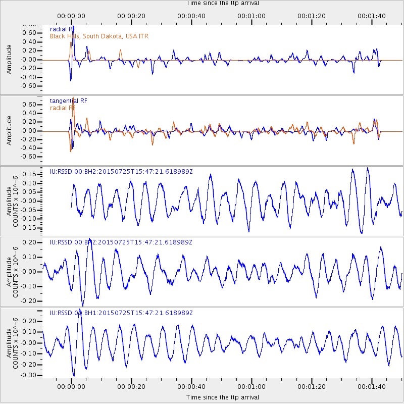
RSSD Black Hills, South Dakota, USA - Earthquake Result Viewer
*The percent match for this event was below the threshold and hence no stack was calculated.
| Earthquake location: |
Kuril Islands |
| Earthquake latitude/longitude: |
43.8/146.2 |
| Earthquake time(UTC): |
2015/07/25 (206) 15:36:38 GMT |
| Earthquake Depth: |
105 km |
| Earthquake Magnitude: |
3.7 mb |
| Earthquake Catalog/Contributor: |
ISC/ISC |
|
| Network: |
IU Global Seismograph Network (GSN - IRIS/USGS) |
| Station: |
RSSD Black Hills, South Dakota, USA |
| Lat/Lon: |
44.12 N/104.04 W |
| Elevation: |
2090 m |
|
| Distance: |
72.4 deg |
| Az: |
45.347 deg |
| Baz: |
314.382 deg |
| Ray Param: |
$rayparam |
*The percent match for this event was below the threshold and hence was not used in the summary stack. |
|
| Radial Match: |
63.077633 % |
| Radial Bump: |
367 |
| Transverse Match: |
65.3979 % |
| Transverse Bump: |
400 |
| SOD ConfigId: |
7422571 |
| Insert Time: |
2019-04-19 22:51:12.426 +0000 |
| GWidth: |
2.5 |
| Max Bumps: |
400 |
| Tol: |
0.001 |
|
Signal To Noise
| Channel | StoN | STA | LTA |
| IU:RSSD:00:BHZ:20150725T15:47:21.618989Z | 1.222749 | 1.1999086E-7 | 9.8132034E-8 |
| IU:RSSD:00:BH1:20150725T15:47:21.618989Z | 2.0438275 | 1.9672518E-7 | 9.625331E-8 |
| IU:RSSD:00:BH2:20150725T15:47:21.618989Z | 1.0038409 | 6.768236E-8 | 6.742339E-8 |
| Arrivals |
| Ps | |
| PpPs | |
| PsPs/PpSs | |


