You are here: Home > Network List > CI - Caltech Regional Seismic Network Stations List
> Station GLA Glamis, California, USA > Earthquake Result Viewer
GLA Glamis, California, USA - Earthquake Result Viewer

| Earthquake location: |
Near Coast Of Peru |
| Earthquake latitude/longitude: |
-16.1/-74.0 |
| Earthquake time(UTC): |
2001/07/05 (186) 13:53:48 GMT |
| Earthquake Depth: |
62 km |
| Earthquake Magnitude: |
6.2 MB, 6.6 MW, 6.5 ME |
| Earthquake Catalog/Contributor: |
WHDF/NEIC |
|
| Network: |
CI Caltech Regional Seismic Network |
| Station: |
GLA Glamis, California, USA |
| Lat/Lon: |
33.05 N/114.83 W |
| Elevation: |
627 m |
|
| Distance: |
62.5 deg |
| Az: |
321.755 deg |
| Baz: |
134.881 deg |
| Ray Param: |
0.06001978 |
| Estimated Moho Depth: |
12.5 km |
| Estimated Crust Vp/Vs: |
2.10 |
| Assumed Crust Vp: |
6.155 km/s |
| Estimated Crust Vs: |
2.934 km/s |
| Estimated Crust Poisson's Ratio: |
0.35 |
|
| Radial Match: |
94.15667 % |
| Radial Bump: |
387 |
| Transverse Match: |
81.8953 % |
| Transverse Bump: |
400 |
| SOD ConfigId: |
3770 |
| Insert Time: |
2010-02-25 21:43:00.377 +0000 |
| GWidth: |
2.5 |
| Max Bumps: |
400 |
| Tol: |
0.001 |
|
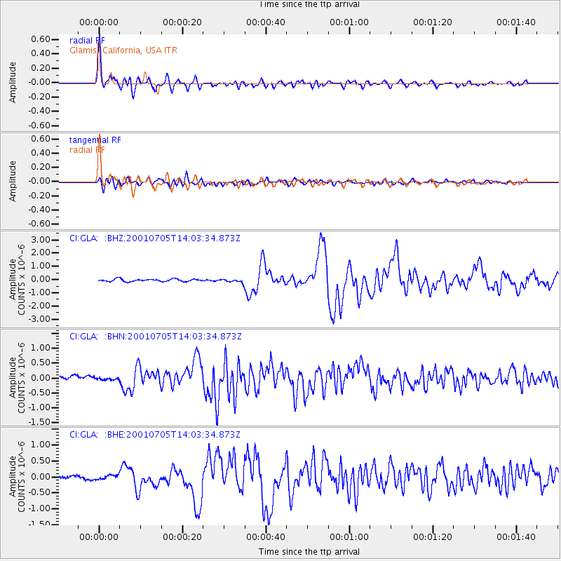
Signal To Noise
| Channel | StoN | STA | LTA |
| CI:GLA: :BHN:20010705T14:03:34.873Z | 0.23961268 | 2.377028E-8 | 9.920293E-8 |
| CI:GLA: :BHE:20010705T14:03:34.873Z | 0.72282463 | 6.5433085E-8 | 9.0524146E-8 |
| CI:GLA: :BHZ:20010705T14:03:34.873Z | 1.489801 | 1.373925E-7 | 9.2222045E-8 |
| Arrivals |
| Ps | 2.3 SECOND |
| PpPs | 6.1 SECOND |
| PsPs/PpSs | 8.4 SECOND |


