You are here: Home > Network List > IU - Global Seismograph Network (GSN - IRIS/USGS) Stations List
> Station CTAO Charters Towers, Australia > Earthquake Result Viewer
CTAO Charters Towers, Australia - Earthquake Result Viewer

| Earthquake location: |
Celebes Sea |
| Earthquake latitude/longitude: |
4.1/122.4 |
| Earthquake time(UTC): |
2009/10/07 (280) 21:41:13 GMT |
| Earthquake Depth: |
574 km |
| Earthquake Magnitude: |
6.3 MB, 6.8 MW, 6.8 MW |
| Earthquake Catalog/Contributor: |
WHDF/NEIC |
|
| Network: |
IU Global Seismograph Network (GSN - IRIS/USGS) |
| Station: |
CTAO Charters Towers, Australia |
| Lat/Lon: |
20.09 S/146.25 E |
| Elevation: |
357 m |
|
| Distance: |
33.6 deg |
| Az: |
136.521 deg |
| Baz: |
313.092 deg |
| Ray Param: |
0.07534348 |
| Estimated Moho Depth: |
32.75 km |
| Estimated Crust Vp/Vs: |
1.84 |
| Assumed Crust Vp: |
6.522 km/s |
| Estimated Crust Vs: |
3.554 km/s |
| Estimated Crust Poisson's Ratio: |
0.29 |
|
| Radial Match: |
96.33414 % |
| Radial Bump: |
277 |
| Transverse Match: |
81.92363 % |
| Transverse Bump: |
400 |
| SOD ConfigId: |
1 |
| Insert Time: |
2010-02-19 00:34:13.884 +0000 |
| GWidth: |
2.5 |
| Max Bumps: |
400 |
| Tol: |
0.001 |
|
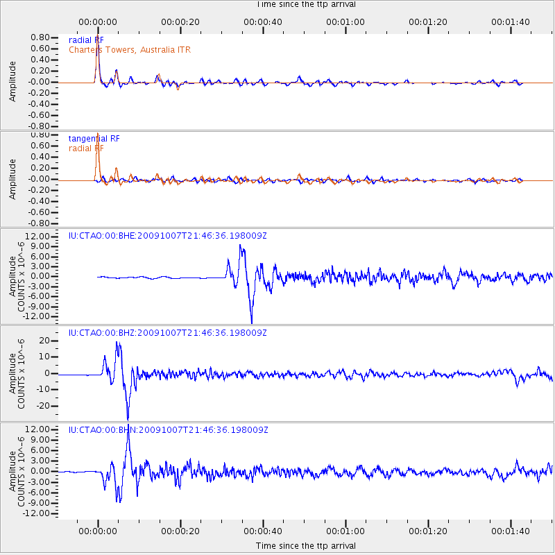
Signal To Noise
| Channel | StoN | STA | LTA |
| IU:CTAO:00:BHZ:20091007T21:46:36.198009Z | 29.679998 | 6.940445E-6 | 2.3384248E-7 |
| IU:CTAO:00:BHN:20091007T21:46:36.198009Z | 33.047047 | 2.8129155E-6 | 8.5118515E-8 |
| IU:CTAO:00:BHE:20091007T21:46:36.198009Z | 18.62656 | 3.3714314E-6 | 1.810013E-7 |
| Arrivals |
| Ps | 4.5 SECOND |
| PpPs | 13 SECOND |
| PsPs/PpSs | 18 SECOND |


