You are here: Home > Network List > AV - Alaska Volcano Observatory Stations List
> Station MAPS Pakushin Southeast, Makushin Volcano, Alaska > Earthquake Result Viewer
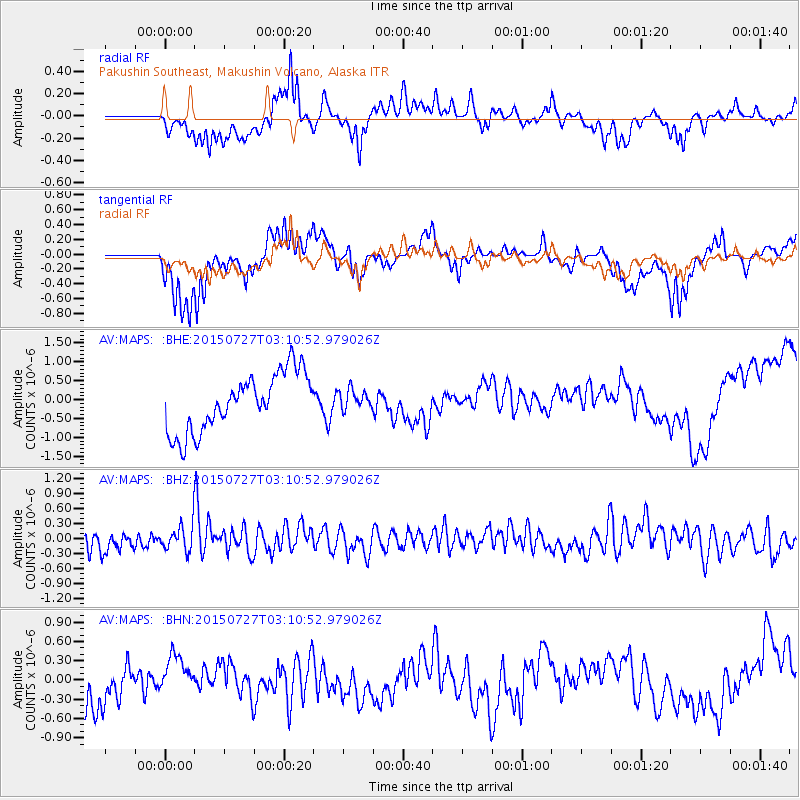
MAPS Pakushin Southeast, Makushin Volcano, Alaska - Earthquake Result Viewer
*The percent match for this event was below the threshold and hence no stack was calculated.
| Earthquake location: |
Tonga Islands Region |
| Earthquake latitude/longitude: |
-22.6/-174.4 |
| Earthquake time(UTC): |
2015/07/27 (208) 02:59:34 GMT |
| Earthquake Depth: |
10 km |
| Earthquake Magnitude: |
4.9 MW |
| Earthquake Catalog/Contributor: |
ISC/ISC |
|
| Network: |
AV Alaska Volcano Observatory |
| Station: |
MAPS Pakushin Southeast, Makushin Volcano, Alaska |
| Lat/Lon: |
53.81 N/166.94 W |
| Elevation: |
333 m |
|
| Distance: |
76.4 deg |
| Az: |
4.573 deg |
| Baz: |
187.135 deg |
| Ray Param: |
$rayparam |
*The percent match for this event was below the threshold and hence was not used in the summary stack. |
|
| Radial Match: |
57.04871 % |
| Radial Bump: |
400 |
| Transverse Match: |
67.83792 % |
| Transverse Bump: |
400 |
| SOD ConfigId: |
7422571 |
| Insert Time: |
2019-04-19 23:19:47.311 +0000 |
| GWidth: |
2.5 |
| Max Bumps: |
400 |
| Tol: |
0.001 |
|
Signal To Noise
| Channel | StoN | STA | LTA |
| AV:MAPS: :BHZ:20150727T03:10:52.979026Z | 1.3094128 | 2.9747164E-7 | 2.2717941E-7 |
| AV:MAPS: :BHN:20150727T03:10:52.979026Z | 0.9516679 | 3.6018167E-7 | 3.784741E-7 |
| AV:MAPS: :BHE:20150727T03:10:52.979026Z | 0.34480968 | 2.621752E-7 | 7.6034763E-7 |
| Arrivals |
| Ps | |
| PpPs | |
| PsPs/PpSs | |


