You are here: Home > Network List > CI - Caltech Regional Seismic Network Stations List
> Station SLA SLA, Trona, CA, USA > Earthquake Result Viewer
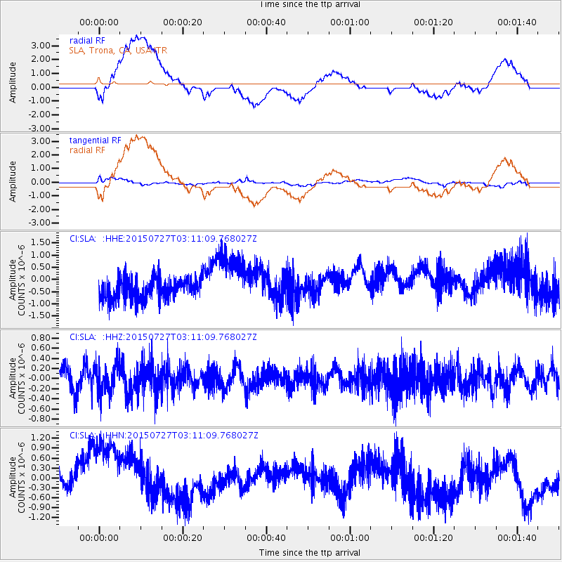
SLA SLA, Trona, CA, USA - Earthquake Result Viewer
*The percent match for this event was below the threshold and hence no stack was calculated.
| Earthquake location: |
Tonga Islands Region |
| Earthquake latitude/longitude: |
-22.6/-174.4 |
| Earthquake time(UTC): |
2015/07/27 (208) 02:59:34 GMT |
| Earthquake Depth: |
10 km |
| Earthquake Magnitude: |
4.9 MW |
| Earthquake Catalog/Contributor: |
ISC/ISC |
|
| Network: |
CI Caltech Regional Seismic Network |
| Station: |
SLA SLA, Trona, CA, USA |
| Lat/Lon: |
35.89 N/117.28 W |
| Elevation: |
1174 m |
|
| Distance: |
79.4 deg |
| Az: |
43.951 deg |
| Baz: |
232.15 deg |
| Ray Param: |
$rayparam |
*The percent match for this event was below the threshold and hence was not used in the summary stack. |
|
| Radial Match: |
58.986935 % |
| Radial Bump: |
400 |
| Transverse Match: |
30.548918 % |
| Transverse Bump: |
400 |
| SOD ConfigId: |
7422571 |
| Insert Time: |
2019-04-19 23:20:58.632 +0000 |
| GWidth: |
2.5 |
| Max Bumps: |
400 |
| Tol: |
0.001 |
|
Signal To Noise
| Channel | StoN | STA | LTA |
| CI:SLA: :HHZ:20150727T03:11:09.768027Z | 1.287131 | 3.0622044E-7 | 2.379093E-7 |
| CI:SLA: :HHN:20150727T03:11:09.768027Z | 3.242824 | 1.2921811E-6 | 3.98474E-7 |
| CI:SLA: :HHE:20150727T03:11:09.768027Z | 2.511498 | 1.150831E-6 | 4.5822495E-7 |
| Arrivals |
| Ps | |
| PpPs | |
| PsPs/PpSs | |


