You are here: Home > Network List > TA - USArray Transportable Network (new EarthScope stations) Stations List
> Station MDND Maddock, ND, USA > Earthquake Result Viewer
MDND Maddock, ND, USA - Earthquake Result Viewer
*The percent match for this event was below the threshold and hence no stack was calculated.
| Earthquake location: |
Fox Islands, Aleutian Islands |
| Earthquake latitude/longitude: |
52.2/-169.5 |
| Earthquake time(UTC): |
2015/07/27 (208) 04:55:45 GMT |
| Earthquake Depth: |
21 km |
| Earthquake Magnitude: |
6.7 MS |
| Earthquake Catalog/Contributor: |
NEIC PDE/NEIC ALERT |
|
| Network: |
TA USArray Transportable Network (new EarthScope stations) |
| Station: |
MDND Maddock, ND, USA |
| Lat/Lon: |
47.85 N/99.60 W |
| Elevation: |
479 m |
|
| Distance: |
43.6 deg |
| Az: |
66.644 deg |
| Baz: |
302.885 deg |
| Ray Param: |
$rayparam |
*The percent match for this event was below the threshold and hence was not used in the summary stack. |
|
| Radial Match: |
61.137745 % |
| Radial Bump: |
400 |
| Transverse Match: |
52.10041 % |
| Transverse Bump: |
400 |
| SOD ConfigId: |
7422571 |
| Insert Time: |
2019-04-19 23:54:55.258 +0000 |
| GWidth: |
2.5 |
| Max Bumps: |
400 |
| Tol: |
0.001 |
|
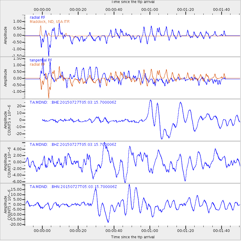
Signal To Noise
| Channel | StoN | STA | LTA |
| TA:MDND: :BHZ:20150727T05:03:15.700006Z | 0.75320774 | 1.0005549E-6 | 1.3283917E-6 |
| TA:MDND: :BHN:20150727T05:03:15.700006Z | 2.234264 | 2.4841718E-6 | 1.1118525E-6 |
| TA:MDND: :BHE:20150727T05:03:15.700006Z | 2.788744 | 3.099936E-6 | 1.1115886E-6 |
| Arrivals |
| Ps | |
| PpPs | |
| PsPs/PpSs | |


