You are here: Home > Network List > UW - Pacific Northwest Regional Seismic Network Stations List
> Station UMAT Pilot Rock, OR, USA > Earthquake Result Viewer
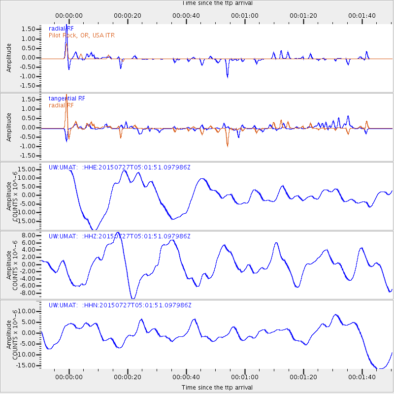
UMAT Pilot Rock, OR, USA - Earthquake Result Viewer
*The percent match for this event was below the threshold and hence no stack was calculated.
| Earthquake location: |
Fox Islands, Aleutian Islands |
| Earthquake latitude/longitude: |
52.2/-169.5 |
| Earthquake time(UTC): |
2015/07/27 (208) 04:55:45 GMT |
| Earthquake Depth: |
21 km |
| Earthquake Magnitude: |
6.7 MS |
| Earthquake Catalog/Contributor: |
NEIC PDE/NEIC ALERT |
|
| Network: |
UW Pacific Northwest Regional Seismic Network |
| Station: |
UMAT Pilot Rock, OR, USA |
| Lat/Lon: |
45.29 N/118.96 W |
| Elevation: |
1318 m |
|
| Distance: |
33.5 deg |
| Az: |
81.325 deg |
| Baz: |
300.363 deg |
| Ray Param: |
$rayparam |
*The percent match for this event was below the threshold and hence was not used in the summary stack. |
|
| Radial Match: |
46.499973 % |
| Radial Bump: |
324 |
| Transverse Match: |
62.958134 % |
| Transverse Bump: |
290 |
| SOD ConfigId: |
7422571 |
| Insert Time: |
2019-04-19 23:56:02.032 +0000 |
| GWidth: |
2.5 |
| Max Bumps: |
400 |
| Tol: |
0.001 |
|
Signal To Noise
| Channel | StoN | STA | LTA |
| UW:UMAT: :HHZ:20150727T05:01:51.097986Z | 2.811972 | 5.782061E-6 | 2.0562302E-6 |
| UW:UMAT: :HHN:20150727T05:01:51.097986Z | 1.3913059 | 4.9824307E-6 | 3.581118E-6 |
| UW:UMAT: :HHE:20150727T05:01:51.097986Z | 0.6885525 | 8.1333665E-6 | 1.1812267E-5 |
| Arrivals |
| Ps | |
| PpPs | |
| PsPs/PpSs | |


