You are here: Home > Network List > US - United States National Seismic Network Stations List
> Station LAO LASA Array, Montana, USA > Earthquake Result Viewer
LAO LASA Array, Montana, USA - Earthquake Result Viewer
*The percent match for this event was below the threshold and hence no stack was calculated.
| Earthquake location: |
Fox Islands, Aleutian Islands |
| Earthquake latitude/longitude: |
52.3/-169.4 |
| Earthquake time(UTC): |
2015/07/27 (208) 06:05:31 GMT |
| Earthquake Depth: |
16 km |
| Earthquake Magnitude: |
5.4 mb |
| Earthquake Catalog/Contributor: |
ISC/ISC |
|
| Network: |
US United States National Seismic Network |
| Station: |
LAO LASA Array, Montana, USA |
| Lat/Lon: |
46.69 N/106.22 W |
| Elevation: |
902 m |
|
| Distance: |
40.2 deg |
| Az: |
71.942 deg |
| Baz: |
301.963 deg |
| Ray Param: |
$rayparam |
*The percent match for this event was below the threshold and hence was not used in the summary stack. |
|
| Radial Match: |
65.09782 % |
| Radial Bump: |
400 |
| Transverse Match: |
48.66684 % |
| Transverse Bump: |
400 |
| SOD ConfigId: |
7422571 |
| Insert Time: |
2019-04-20 00:03:08.782 +0000 |
| GWidth: |
2.5 |
| Max Bumps: |
400 |
| Tol: |
0.001 |
|
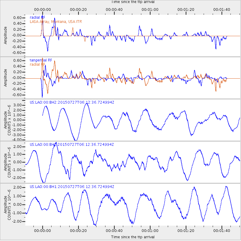
Signal To Noise
| Channel | StoN | STA | LTA |
| US:LAO:00:BHZ:20150727T06:12:36.724994Z | 2.9952593 | 1.9270096E-6 | 6.4335325E-7 |
| US:LAO:00:BH1:20150727T06:12:36.724994Z | 0.34410483 | 4.6157393E-7 | 1.341376E-6 |
| US:LAO:00:BH2:20150727T06:12:36.724994Z | 0.44151524 | 9.903297E-7 | 2.243025E-6 |
| Arrivals |
| Ps | |
| PpPs | |
| PsPs/PpSs | |


