You are here: Home > Network List > TA - USArray Transportable Network (new EarthScope stations) Stations List
> Station E64A Bridgewater, ME, USA > Earthquake Result Viewer
E64A Bridgewater, ME, USA - Earthquake Result Viewer

| Earthquake location: |
Fox Islands, Aleutian Islands |
| Earthquake latitude/longitude: |
52.2/-169.2 |
| Earthquake time(UTC): |
2015/07/27 (208) 06:19:31 GMT |
| Earthquake Depth: |
21 km |
| Earthquake Magnitude: |
5.0 mb |
| Earthquake Catalog/Contributor: |
ISC/ISC |
|
| Network: |
TA USArray Transportable Network (new EarthScope stations) |
| Station: |
E64A Bridgewater, ME, USA |
| Lat/Lon: |
46.42 N/67.83 W |
| Elevation: |
190 m |
|
| Distance: |
61.0 deg |
| Az: |
50.836 deg |
| Baz: |
316.386 deg |
| Ray Param: |
0.061136145 |
| Estimated Moho Depth: |
48.25 km |
| Estimated Crust Vp/Vs: |
1.90 |
| Assumed Crust Vp: |
6.419 km/s |
| Estimated Crust Vs: |
3.383 km/s |
| Estimated Crust Poisson's Ratio: |
0.31 |
|
| Radial Match: |
85.16144 % |
| Radial Bump: |
400 |
| Transverse Match: |
73.04435 % |
| Transverse Bump: |
400 |
| SOD ConfigId: |
7422571 |
| Insert Time: |
2019-04-20 00:17:31.229 +0000 |
| GWidth: |
2.5 |
| Max Bumps: |
400 |
| Tol: |
0.001 |
|
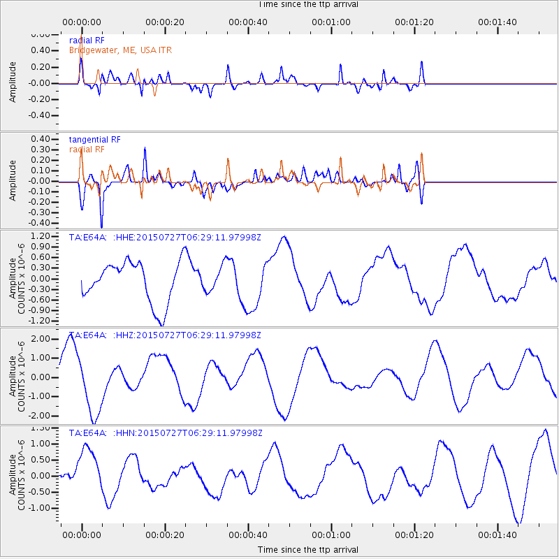
Signal To Noise
| Channel | StoN | STA | LTA |
| TA:E64A: :HHZ:20150727T06:29:11.97998Z | 2.5001369 | 1.5279492E-6 | 6.111462E-7 |
| TA:E64A: :HHN:20150727T06:29:11.97998Z | 1.0960083 | 7.348353E-7 | 6.7046506E-7 |
| TA:E64A: :HHE:20150727T06:29:11.97998Z | 0.6241085 | 3.6075068E-7 | 5.7802555E-7 |
| Arrivals |
| Ps | 7.0 SECOND |
| PpPs | 21 SECOND |
| PsPs/PpSs | 28 SECOND |


