You are here: Home > Network List > US - United States National Seismic Network Stations List
> Station HAWA Hanford, Washington, USA > Earthquake Result Viewer
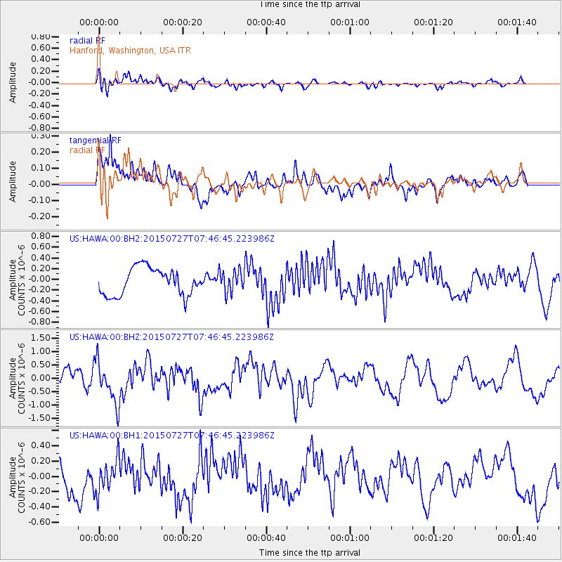
HAWA Hanford, Washington, USA - Earthquake Result Viewer
*The percent match for this event was below the threshold and hence no stack was calculated.
| Earthquake location: |
Fox Islands, Aleutian Islands |
| Earthquake latitude/longitude: |
52.3/-169.1 |
| Earthquake time(UTC): |
2015/07/27 (208) 07:40:49 GMT |
| Earthquake Depth: |
33 km |
| Earthquake Magnitude: |
5.5 mb |
| Earthquake Catalog/Contributor: |
ISC/ISC |
|
| Network: |
US United States National Seismic Network |
| Station: |
HAWA Hanford, Washington, USA |
| Lat/Lon: |
46.39 N/119.53 W |
| Elevation: |
364 m |
|
| Distance: |
32.3 deg |
| Az: |
80.391 deg |
| Baz: |
298.951 deg |
| Ray Param: |
$rayparam |
*The percent match for this event was below the threshold and hence was not used in the summary stack. |
|
| Radial Match: |
72.17226 % |
| Radial Bump: |
400 |
| Transverse Match: |
69.43413 % |
| Transverse Bump: |
400 |
| SOD ConfigId: |
7422571 |
| Insert Time: |
2019-04-20 00:43:35.141 +0000 |
| GWidth: |
2.5 |
| Max Bumps: |
400 |
| Tol: |
0.001 |
|
Signal To Noise
| Channel | StoN | STA | LTA |
| US:HAWA:00:BHZ:20150727T07:46:45.223986Z | 2.9713933 | 7.992597E-7 | 2.689848E-7 |
| US:HAWA:00:BH1:20150727T07:46:45.223986Z | 1.1039119 | 2.1572686E-7 | 1.9542036E-7 |
| US:HAWA:00:BH2:20150727T07:46:45.223986Z | 0.7917508 | 1.9703111E-7 | 2.4885497E-7 |
| Arrivals |
| Ps | |
| PpPs | |
| PsPs/PpSs | |


