You are here: Home > Network List > TA - USArray Transportable Network (new EarthScope stations) Stations List
> Station 833A Chaparral WMA, Artesia Wells, TX, USA > Earthquake Result Viewer
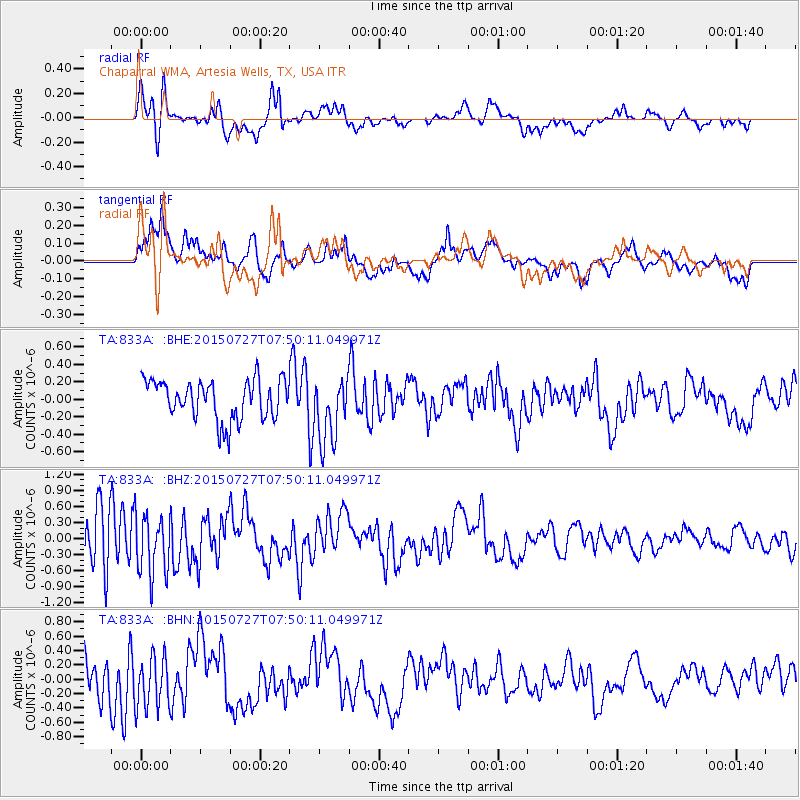
833A Chaparral WMA, Artesia Wells, TX, USA - Earthquake Result Viewer
*The percent match for this event was below the threshold and hence no stack was calculated.
| Earthquake location: |
Fox Islands, Aleutian Islands |
| Earthquake latitude/longitude: |
52.5/-169.7 |
| Earthquake time(UTC): |
2015/07/27 (208) 07:41:02 GMT |
| Earthquake Depth: |
16 km |
| Earthquake Magnitude: |
5.6 MB |
| Earthquake Catalog/Contributor: |
NEIC PDE/NEIC COMCAT |
|
| Network: |
TA USArray Transportable Network (new EarthScope stations) |
| Station: |
833A Chaparral WMA, Artesia Wells, TX, USA |
| Lat/Lon: |
28.32 N/99.39 W |
| Elevation: |
171 m |
|
| Distance: |
56.3 deg |
| Az: |
86.264 deg |
| Baz: |
316.162 deg |
| Ray Param: |
$rayparam |
*The percent match for this event was below the threshold and hence was not used in the summary stack. |
|
| Radial Match: |
78.606995 % |
| Radial Bump: |
400 |
| Transverse Match: |
75.27421 % |
| Transverse Bump: |
400 |
| SOD ConfigId: |
7422571 |
| Insert Time: |
2019-04-20 00:50:42.626 +0000 |
| GWidth: |
2.5 |
| Max Bumps: |
400 |
| Tol: |
0.001 |
|
Signal To Noise
| Channel | StoN | STA | LTA |
| TA:833A: :BHZ:20150727T07:50:11.049971Z | 1.1086267 | 5.476825E-7 | 4.940188E-7 |
| TA:833A: :BHN:20150727T07:50:11.049971Z | 1.4225639 | 3.5711363E-7 | 2.5103523E-7 |
| TA:833A: :BHE:20150727T07:50:11.049971Z | 1.6631894 | 3.789066E-7 | 2.2781927E-7 |
| Arrivals |
| Ps | |
| PpPs | |
| PsPs/PpSs | |


